
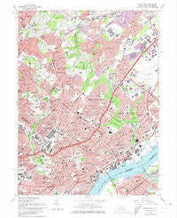
~ Frankford PA topo map, 1:24000 scale, 7.5 X 7.5 Minute, Historical, 1967, updated 1974
Frankford, Pennsylvania, USGS topographic map dated 1967.
Includes geographic coordinates (latitude and longitude). This topographic map is suitable for hiking, camping, and exploring, or framing it as a wall map.
Printed on-demand using high resolution imagery, on heavy weight and acid free paper, or alternatively on a variety of synthetic materials.
Topos available on paper, Waterproof, Poly, or Tyvek. Usually shipping rolled, unless combined with other folded maps in one order.
- Product Number: USGS-5323896
- Free digital map download (high-resolution, GeoPDF): Frankford, Pennsylvania (file size: 17 MB)
- Map Size: please refer to the dimensions of the GeoPDF map above
- Weight (paper map): ca. 55 grams
- Map Type: POD USGS Topographic Map
- Map Series: HTMC
- Map Verison: Historical
- Cell ID: 70117
- Scan ID: 172543
- Imprint Year: 1974
- Woodland Tint: Yes
- Photo Revision Year: 1973
- Aerial Photo Year: 1973
- Field Check Year: 1967
- Survey Year: 1947
- Datum: NAD27
- Map Projection: Polyconic
- Map published by United States Geological Survey
- Map Language: English
- Scanner Resolution: 600 dpi
- Map Cell Name: Frankford
- Grid size: 7.5 X 7.5 Minute
- Date on map: 1967
- Map Scale: 1:24000
- Geographical region: Pennsylvania, United States
Neighboring Maps:
All neighboring USGS topo maps are available for sale online at a variety of scales.
Spatial coverage:
Topo map Frankford, Pennsylvania, covers the geographical area associated the following places:
- Pennypack - Meadowbrook - Northwood - Lagrange - Oxford Circle - Holme Circle - Huntingdon Valley - Oaklane - Winchester Park - Olney - Bustleton - Summerdale - Rydal East - Cedar Grove - Lawncrest - Lexington Park - Wissinoming - Rydal Park - Fox Chase - Cheltenham Village - High Rue - Riverton - Philmont - Vereeville - Lawn Crest - Rydal Green - Chapel Hill Manor - Tacony - Oxford Village - Gloria Dei Towers - Rydall Park - Walnut Hill - Crescentville - Rockledge - Noble - Pauls Run - Ashmead Village - Mayfair - Lawndale - Bridesburg - Wyndmoor Estates - Fitler - Harrisburg - Palmyra - Holmesburg - Ryers - Rhawnhurst - Juniata - Torresdale - Crosswicks - Blue Grass - Oak Lane Manor - Frankford - Oak Lane - Cheltenham - Rydal Estates - Somerton - Abington - Elkins Park Gardens - Foxcroft Square - Bethayres - Pennypack Woods - Valley Falls - Rydal - McKinley - Ashton Wooden Bridge - Hollywood - Upper Holmesburg - Burholme - Volunteertown - Coventry House
- Map Area ID: AREA40.12540-75.125-75
- Northwest corner Lat/Long code: USGSNW40.125-75.125
- Northeast corner Lat/Long code: USGSNE40.125-75
- Southwest corner Lat/Long code: USGSSW40-75.125
- Southeast corner Lat/Long code: USGSSE40-75
- Northern map edge Latitude: 40.125
- Southern map edge Latitude: 40
- Western map edge Longitude: -75.125
- Eastern map edge Longitude: -75


