
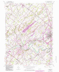
~ Doylestown PA topo map, 1:24000 scale, 7.5 X 7.5 Minute, Historical, 1953, updated 1984
Doylestown, Pennsylvania, USGS topographic map dated 1953.
Includes geographic coordinates (latitude and longitude). This topographic map is suitable for hiking, camping, and exploring, or framing it as a wall map.
Printed on-demand using high resolution imagery, on heavy weight and acid free paper, or alternatively on a variety of synthetic materials.
Topos available on paper, Waterproof, Poly, or Tyvek. Usually shipping rolled, unless combined with other folded maps in one order.
- Product Number: USGS-5323394
- Free digital map download (high-resolution, GeoPDF): Doylestown, Pennsylvania (file size: 10 MB)
- Map Size: please refer to the dimensions of the GeoPDF map above
- Weight (paper map): ca. 55 grams
- Map Type: POD USGS Topographic Map
- Map Series: HTMC
- Map Verison: Historical
- Cell ID: 12743
- Scan ID: 170619
- Imprint Year: 1984
- Woodland Tint: Yes
- Photo Revision Year: 1983
- Aerial Photo Year: 1981
- Edit Year: 1983
- Datum: NAD27
- Map Projection: Polyconic
- Map published by United States Geological Survey
- Map Language: English
- Scanner Resolution: 600 dpi
- Map Cell Name: Doylestown
- Grid size: 7.5 X 7.5 Minute
- Date on map: 1953
- Map Scale: 1:24000
- Geographical region: Pennsylvania, United States
Neighboring Maps:
All neighboring USGS topo maps are available for sale online at a variety of scales.
Spatial coverage:
Topo map Doylestown, Pennsylvania, covers the geographical area associated the following places:
- Fountainville - Clayton Hill II - Kendigtown - Brittany Farms - Montgomery Glen - Danboro - Brookshyre Woods - New Britain - Mount Pleasant - Chalfont - New Galena - Griers Corner - Bridge Point - Edison - Loux Corner - Wrenfield - Doylestown - Forest Park - Tradesville - Leidytown - Farm School - Little Farm Trace Park - Patriot Place - Pine Run - Winners Circle - Heather Knoll - Blooming Glen - The Highlands - Naces Corner - Avallon at Moyers - Cross Keys - Newville - Briarwyck - Lindenfield - Dublin - Castle Valley - Meadow Lane Farms - New Galena (historical)
- Map Area ID: AREA40.37540.25-75.25-75.125
- Northwest corner Lat/Long code: USGSNW40.375-75.25
- Northeast corner Lat/Long code: USGSNE40.375-75.125
- Southwest corner Lat/Long code: USGSSW40.25-75.25
- Southeast corner Lat/Long code: USGSSE40.25-75.125
- Northern map edge Latitude: 40.375
- Southern map edge Latitude: 40.25
- Western map edge Longitude: -75.25
- Eastern map edge Longitude: -75.125


