
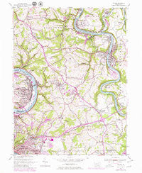
~ Donora PA topo map, 1:24000 scale, 7.5 X 7.5 Minute, Historical, 1954, updated 1979
Donora, Pennsylvania, USGS topographic map dated 1954.
Includes geographic coordinates (latitude and longitude). This topographic map is suitable for hiking, camping, and exploring, or framing it as a wall map.
Printed on-demand using high resolution imagery, on heavy weight and acid free paper, or alternatively on a variety of synthetic materials.
Topos available on paper, Waterproof, Poly, or Tyvek. Usually shipping rolled, unless combined with other folded maps in one order.
- Product Number: USGS-5323352
- Free digital map download (high-resolution, GeoPDF): Donora, Pennsylvania (file size: 13 MB)
- Map Size: please refer to the dimensions of the GeoPDF map above
- Weight (paper map): ca. 55 grams
- Map Type: POD USGS Topographic Map
- Map Series: HTMC
- Map Verison: Historical
- Cell ID: 12548
- Scan ID: 170598
- Imprint Year: 1979
- Woodland Tint: Yes
- Visual Version Number: 1
- Photo Revision Year: 1979
- Aerial Photo Year: 1977
- Edit Year: 1979
- Field Check Year: 1954
- Datum: NAD27
- Map Projection: Polyconic
- Map published by United States Geological Survey
- Map Language: English
- Scanner Resolution: 600 dpi
- Map Cell Name: Donora
- Grid size: 7.5 X 7.5 Minute
- Date on map: 1954
- Map Scale: 1:24000
- Geographical region: Pennsylvania, United States
Neighboring Maps:
All neighboring USGS topo maps are available for sale online at a variety of scales.
Spatial coverage:
Topo map Donora, Pennsylvania, covers the geographical area associated the following places:
- Pricedale - Port Royal - Rankins Corners - Webster - Sweeneys Crossroads - Millesville - Crestview - Wilko Hill - Fitz Henry - Donora - West Newton - Blackburn (historical) - North Belle Vernon - Sutersville - Belle Vernon - Collinsburg - Blythedale - Douglass - Gratztown - Allens Crossroads - Lowber - Fellsburg - Reduction - Grandview - Smithdale - Mustard
- Map Area ID: AREA40.2540.125-79.875-79.75
- Northwest corner Lat/Long code: USGSNW40.25-79.875
- Northeast corner Lat/Long code: USGSNE40.25-79.75
- Southwest corner Lat/Long code: USGSSW40.125-79.875
- Southeast corner Lat/Long code: USGSSE40.125-79.75
- Northern map edge Latitude: 40.25
- Southern map edge Latitude: 40.125
- Western map edge Longitude: -79.875
- Eastern map edge Longitude: -79.75


