
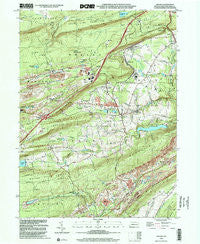
~ Delano PA topo map, 1:24000 scale, 7.5 X 7.5 Minute, Historical, 1999, updated 2001
Delano, Pennsylvania, USGS topographic map dated 1999.
Includes geographic coordinates (latitude and longitude). This topographic map is suitable for hiking, camping, and exploring, or framing it as a wall map.
Printed on-demand using high resolution imagery, on heavy weight and acid free paper, or alternatively on a variety of synthetic materials.
Topos available on paper, Waterproof, Poly, or Tyvek. Usually shipping rolled, unless combined with other folded maps in one order.
- Product Number: USGS-5323266
- Free digital map download (high-resolution, GeoPDF): Delano, Pennsylvania (file size: 13 MB)
- Map Size: please refer to the dimensions of the GeoPDF map above
- Weight (paper map): ca. 55 grams
- Map Type: POD USGS Topographic Map
- Map Series: HTMC
- Map Verison: Historical
- Cell ID: 11828
- Scan ID: 223288
- Imprint Year: 2001
- Woodland Tint: Yes
- Aerial Photo Year: 1999
- Datum: NAD83
- Map Projection: Universal Transverse Mercator
- Map published by United States Geological Survey
- Map Language: English
- Scanner Resolution: 600 dpi
- Map Cell Name: Delano
- Grid size: 7.5 X 7.5 Minute
- Date on map: 1999
- Map Scale: 1:24000
- Geographical region: Pennsylvania, United States
Neighboring Maps:
All neighboring USGS topo maps are available for sale online at a variety of scales.
Spatial coverage:
Topo map Delano, Pennsylvania, covers the geographical area associated the following places:
- Buck Mountain - Park Crest - Hazleton Junction - Laurel Junction - Vulcan - Girard Manor - Trenton - Maryd - Tamanend - Locust Valley - Haucks - Barnesville - Hosensock - Park Place - Pine Junction - Tuscarora - Grier City - Quakake - Delano - Lofty - Reevesdale - Ginther - East Mahanoy Junction
- Map Area ID: AREA40.87540.75-76.125-76
- Northwest corner Lat/Long code: USGSNW40.875-76.125
- Northeast corner Lat/Long code: USGSNE40.875-76
- Southwest corner Lat/Long code: USGSSW40.75-76.125
- Southeast corner Lat/Long code: USGSSE40.75-76
- Northern map edge Latitude: 40.875
- Southern map edge Latitude: 40.75
- Western map edge Longitude: -76.125
- Eastern map edge Longitude: -76


