
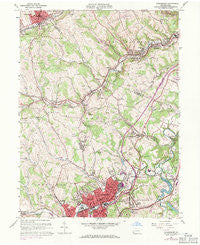
~ Canonsburg PA topo map, 1:24000 scale, 7.5 X 7.5 Minute, Historical, 1960, updated 1971
Canonsburg, Pennsylvania, USGS topographic map dated 1960.
Includes geographic coordinates (latitude and longitude). This topographic map is suitable for hiking, camping, and exploring, or framing it as a wall map.
Printed on-demand using high resolution imagery, on heavy weight and acid free paper, or alternatively on a variety of synthetic materials.
Topos available on paper, Waterproof, Poly, or Tyvek. Usually shipping rolled, unless combined with other folded maps in one order.
- Product Number: USGS-5322602
- Free digital map download (high-resolution, GeoPDF): Canonsburg, Pennsylvania (file size: 13 MB)
- Map Size: please refer to the dimensions of the GeoPDF map above
- Weight (paper map): ca. 55 grams
- Map Type: POD USGS Topographic Map
- Map Series: HTMC
- Map Verison: Historical
- Cell ID: 7095
- Scan ID: 172891
- Imprint Year: 1971
- Woodland Tint: Yes
- Photo Revision Year: 1969
- Aerial Photo Year: 1969
- Field Check Year: 1953
- Datum: NAD27
- Map Projection: Polyconic
- Map published by United States Geological Survey
- Map Language: English
- Scanner Resolution: 600 dpi
- Map Cell Name: Canonsburg
- Grid size: 7.5 X 7.5 Minute
- Date on map: 1960
- Map Scale: 1:24000
- Geographical region: Pennsylvania, United States
Neighboring Maps:
All neighboring USGS topo maps are available for sale online at a variety of scales.
Spatial coverage:
Topo map Canonsburg, Pennsylvania, covers the geographical area associated the following places:
- Van Emman - Cowden - Sygan Hill - Venice - McNary - Murry Hill - Bishop - Morgan - Sygan - McDonald - Canonsburg - Strabane - Laurel Hill - McConnells Mills - Morgan Hill - Hendersonville - Gladden - Cuddy Hill - Cecil - Cool Valley - Muse - Treveskyn - Donaldsons Crossroads - Gladden Heights - Weavertown - Morganza - National Hill - Midland - Muse Junction - Reissing - Borland Manor
- Map Area ID: AREA40.37540.25-80.25-80.125
- Northwest corner Lat/Long code: USGSNW40.375-80.25
- Northeast corner Lat/Long code: USGSNE40.375-80.125
- Southwest corner Lat/Long code: USGSSW40.25-80.25
- Southeast corner Lat/Long code: USGSSE40.25-80.125
- Northern map edge Latitude: 40.375
- Southern map edge Latitude: 40.25
- Western map edge Longitude: -80.25
- Eastern map edge Longitude: -80.125


