
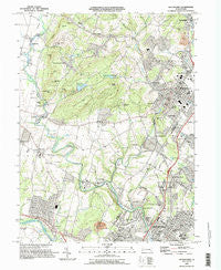
~ Boyertown PA topo map, 1:24000 scale, 7.5 X 7.5 Minute, Historical, 1995, updated 1996
Boyertown, Pennsylvania, USGS topographic map dated 1995.
Includes geographic coordinates (latitude and longitude). This topographic map is suitable for hiking, camping, and exploring, or framing it as a wall map.
Printed on-demand using high resolution imagery, on heavy weight and acid free paper, or alternatively on a variety of synthetic materials.
Topos available on paper, Waterproof, Poly, or Tyvek. Usually shipping rolled, unless combined with other folded maps in one order.
- Product Number: USGS-5322366
- Free digital map download (high-resolution, GeoPDF): Boyertown, Pennsylvania (file size: 13 MB)
- Map Size: please refer to the dimensions of the GeoPDF map above
- Weight (paper map): ca. 55 grams
- Map Type: POD USGS Topographic Map
- Map Series: HTMC
- Map Verison: Historical
- Cell ID: 5151
- Scan ID: 223481
- Imprint Year: 1996
- Woodland Tint: Yes
- Aerial Photo Year: 1992
- Edit Year: 1996
- Field Check Year: 1995
- Datum: NAD83
- Map Projection: Universal Transverse Mercator
- Map published by United States Geological Survey
- Map Language: English
- Scanner Resolution: 600 dpi
- Map Cell Name: Boyertown
- Grid size: 7.5 X 7.5 Minute
- Date on map: 1995
- Map Scale: 1:24000
- Geographical region: Pennsylvania, United States
Neighboring Maps:
All neighboring USGS topo maps are available for sale online at a variety of scales.
Spatial coverage:
Topo map Boyertown, Pennsylvania, covers the geographical area associated the following places:
- Greenbriar - Woodchoppertown - Shanesville - Boyertown - Indian Springs Village - West Pottsgrove - Greshville - Earlville - Morysville - Englesville - Gabelsville - Upper Glasgow - New Berlinville - Pine Forge - Colebrookdale - Glasgow - Amityville - Brookview - Halfway House - Half Way House - Cider Mill Run - Worman - Stowe - Spangsville - Cedar Grove - Orchard Hills - Washington Hill - Ironstone - Amity Gardens - Hanover Court - Rosecliff - High Meadows - Bechtelsville - Douglassville - Little Oley - Woods Edge
- Map Area ID: AREA40.37540.25-75.75-75.625
- Northwest corner Lat/Long code: USGSNW40.375-75.75
- Northeast corner Lat/Long code: USGSNE40.375-75.625
- Southwest corner Lat/Long code: USGSSW40.25-75.75
- Southeast corner Lat/Long code: USGSSE40.25-75.625
- Northern map edge Latitude: 40.375
- Southern map edge Latitude: 40.25
- Western map edge Longitude: -75.75
- Eastern map edge Longitude: -75.625


