
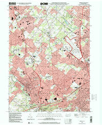
~ Ambler PA topo map, 1:24000 scale, 7.5 X 7.5 Minute, Historical, 1999, updated 2001
Ambler, Pennsylvania, USGS topographic map dated 1999.
Includes geographic coordinates (latitude and longitude). This topographic map is suitable for hiking, camping, and exploring, or framing it as a wall map.
Printed on-demand using high resolution imagery, on heavy weight and acid free paper, or alternatively on a variety of synthetic materials.
Topos available on paper, Waterproof, Poly, or Tyvek. Usually shipping rolled, unless combined with other folded maps in one order.
- Product Number: USGS-5321764
- Free digital map download (high-resolution, GeoPDF): Ambler, Pennsylvania (file size: 13 MB)
- Map Size: please refer to the dimensions of the GeoPDF map above
- Weight (paper map): ca. 55 grams
- Map Type: POD USGS Topographic Map
- Map Series: HTMC
- Map Verison: Historical
- Cell ID: 831
- Scan ID: 223385
- Imprint Year: 2001
- Woodland Tint: Yes
- Aerial Photo Year: 1999
- Field Check Year: 1952
- Datum: NAD83
- Map Projection: Universal Transverse Mercator
- Map published by United States Geological Survey
- Map Language: English
- Scanner Resolution: 600 dpi
- Map Cell Name: Ambler
- Grid size: 7.5 X 7.5 Minute
- Date on map: 1999
- Map Scale: 1:24000
- Geographical region: Pennsylvania, United States
Neighboring Maps:
All neighboring USGS topo maps are available for sale online at a variety of scales.
Spatial coverage:
Topo map Ambler, Pennsylvania, covers the geographical area associated the following places:
- Montgomery Oaks - Tannerie Woods - Ambler House - Meadow View Estates - Horsham Terrace - Cloverly Farms - Spring House - Dublin Meadows - Dawesfield - Mercer Hill Village - Gwynedd Estates - Willow Manor - Dublin Estates - Broad Axe - Three Tuns - Hallowell - Meetinghouse Village - Rose Valley - The Meadows - Palomino Farms - Stuart Creek Farms - Estates of Horsham Lea - Estates at Cedar Hill - Pheasant Knoll - Dublin Chase - Upper Dublin - Montgomery Greeny - Talamore at Oak Terrace - Horsham Chase - Dublin Crossing - De La Salle - Gwynedd Lea - Dresher - Dublin Glen - Neshaminy - The Woods - Parsons Glen - Wynmere Downs - Gwynn Oaks - Roslyn - Wister Woods - Mount Pleasant - Pennbrooke Manor - Windsor Pass - Estates of Montgomery - Squires Knoll - Welsh Woods - Arbor Glen - Crestmont - Saw Mill Valley - Talamore - Eureka - Maple Glen - Georgetown of Philadelphia - Willow Manor Farms - Ambler - Victoria Glen - Montgomeryville - Meadowcreek Estates - Dresher Woods - Warrington - Estate of Dublin - Fort Washington - Meadows at Lower Gwynedd - Wooded Pond - Willowmere - Prospectville - Gwynedd Knoll - Dreshertowne - The Reserve at Trewellyn - Pen Ambler - Fairoaks - Jarrettown - Broad Axe Village - Trewellyn Estates - Carpenters Way - Gwynmont Farms - Horsham - Dublin Hunt II - Squires Estates - The Woodlands - Maple Glen Hollow - Myers Tract - Penllyn - Winding Estates - Dublin Lea - Montgomery Crossing - Greystone Manor - The Ridings of Montgomery - The Meadows of Horsham Towne - Hampton Green
- Map Area ID: AREA40.2540.125-75.25-75.125
- Northwest corner Lat/Long code: USGSNW40.25-75.25
- Northeast corner Lat/Long code: USGSNE40.25-75.125
- Southwest corner Lat/Long code: USGSSW40.125-75.25
- Southeast corner Lat/Long code: USGSSE40.125-75.125
- Northern map edge Latitude: 40.25
- Southern map edge Latitude: 40.125
- Western map edge Longitude: -75.25
- Eastern map edge Longitude: -75.125


