
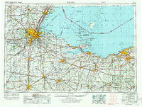
~ Toledo OH topo map, 1:250000 scale, 1 X 2 Degree, Historical, 1956, updated 1972
Toledo, Ohio, USGS topographic map dated 1956.
Includes geographic coordinates (latitude and longitude). This topographic map is suitable for hiking, camping, and exploring, or framing it as a wall map.
Printed on-demand using high resolution imagery, on heavy weight and acid free paper, or alternatively on a variety of synthetic materials.
Topos available on paper, Waterproof, Poly, or Tyvek. Usually shipping rolled, unless combined with other folded maps in one order.
- Product Number: USGS-5321604
- Free digital map download (high-resolution, GeoPDF): Toledo, Ohio (file size: 16 MB)
- Map Size: please refer to the dimensions of the GeoPDF map above
- Weight (paper map): ca. 55 grams
- Map Type: POD USGS Topographic Map
- Map Series: HTMC
- Map Verison: Historical
- Cell ID: 69054
- Scan ID: 226806
- Imprint Year: 1972
- Woodland Tint: Yes
- Aerial Photo Year: 1951
- Edit Year: 1969
- Field Check Year: 1956
- Datum: Unstated
- Map Projection: Transverse Mercator
- Map published by United States Geological Survey
- Map published by: Military, Other
- Map Language: English
- Scanner Resolution: 600 dpi
- Map Cell Name: Toledo
- Grid size: 1 X 2 Degree
- Date on map: 1956
- Map Scale: 1:250000
- Geographical region: Ohio, United States
Neighboring Maps:
All neighboring USGS topo maps are available for sale online at a variety of scales.
Spatial coverage:
Topo map Toledo, Ohio, covers the geographical area associated the following places:
- Northgate - Peru - Brighton - Belmont Farms - Deer Ridge Mobile Home Park - West Toledo - Meigs on the River - Laporte - Village Green Mobile Home Park - Volunteer Bay - Boughtonville - Ogden Center - Avon Lake - Hopewell Heights - Chase - Maple Grove (historical) - Cedar Point - D'Arcy Estates - Petersburg Junction - Shorewood Village - Gould - West Lodi - Gilboa - Risingsun - La Salle - Rudolph - Lake Breeze - Sharples - Herefork - Walnut Hills Mobile Home Park - Green Springs - Lowell - Niles Beach - Castalia - McComb - Havana - Columbus Park - Scotch Ridge - Whites Landing - Park Du Langlade - Golfcrest - Tiffin - White Fox - Longley - Orchard View - Shoreway Mobile Home Park - Wood Lake Mobile Home Park - Sunset Point Trailer Park - Oil Center (historical) - Baywater Estates - Burgoon - Thomsontown (historical) - Hobart - Melmore - Moline - Crandall - Parliament Place - South Swanton - Boulevard - Dixon - Ridgewood Mobile Home Park - Holiday South Mobile Home Park - Trinity (historical) - Oakpoint (historical) - Colonial Villa - Venice - Riverview Trailer Court - Chatham - Havens - Detroit Beach - Midway (historical) - Strongs Ridge - Muncie Hollow - Penfield Junction - Pine Villas - Semples - Helena - Booktown - Pawnee - Steiner - Wayne - Riverdale (historical) - Standardsburg - Esselburn - Raker Corners - Immergrun - Folger (historical) - Linden (historical) - Petersburg - Colby - Siney (historical) - Ottawa - Woodland Beach - Kelleys Island - Rustic Hills Mobile Home Park - Reynolds Corners - Lemoyne - Lakeside - Berlin Heights Station - Hidden Creek Manufactured Home Community
- Map Area ID: AREA4241-84-82
- Northwest corner Lat/Long code: USGSNW42-84
- Northeast corner Lat/Long code: USGSNE42-82
- Southwest corner Lat/Long code: USGSSW41-84
- Southeast corner Lat/Long code: USGSSE41-82
- Northern map edge Latitude: 42
- Southern map edge Latitude: 41
- Western map edge Longitude: -84
- Eastern map edge Longitude: -82


