
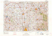
~ Marion OH topo map, 1:250000 scale, 1 X 2 Degree, Historical, 1966, updated 1968
Marion, Ohio, USGS topographic map dated 1966.
Includes geographic coordinates (latitude and longitude). This topographic map is suitable for hiking, camping, and exploring, or framing it as a wall map.
Printed on-demand using high resolution imagery, on heavy weight and acid free paper, or alternatively on a variety of synthetic materials.
Topos available on paper, Waterproof, Poly, or Tyvek. Usually shipping rolled, unless combined with other folded maps in one order.
- Product Number: USGS-5321594
- Free digital map download (high-resolution, GeoPDF): Marion, Ohio (file size: 16 MB)
- Map Size: please refer to the dimensions of the GeoPDF map above
- Weight (paper map): ca. 55 grams
- Map Type: POD USGS Topographic Map
- Map Series: HTMC
- Map Verison: Historical
- Cell ID: 75002
- Scan ID: 225744
- Imprint Year: 1968
- Woodland Tint: Yes
- Visual Version Number: 1
- Aerial Photo Year: 1960
- Field Check Year: 1966
- Survey Year: 1964
- Datum: NAD27
- Map Projection: Universal Transverse Mercator
- Map published by United States Geological Survey
- Map Language: English
- Scanner Resolution: 600 dpi
- Map Cell Name: Marion
- Grid size: 1 X 2 Degree
- Date on map: 1966
- Map Scale: 1:250000
- Geographical region: Ohio, United States
Neighboring Maps:
All neighboring USGS topo maps are available for sale online at a variety of scales.
Spatial coverage:
Topo map Marion, Ohio, covers the geographical area associated the following places:
- Adario - North Lewisburg - Peerless (historical) - Lakeview Meadows - Pickett Place - Carefree Estates - Blocktown (historical) - Villas At Hawks Crest - McCutchenville - Ashton Meadows - Woodcrest - Stewart (historical) - Gretna - Richlanne Acres - Briarwood Estates Mobile Home Park - Cokesbury Corners - Meadowbrook Mobile Home Park - Academia - Waynesburg - Dalrymple Corners - Overton - Cedar Valley - Hidden Valley Mobile Home Park - Rosedale - Morgan Center - Blooming Grove - North Robinson - Chatfield - Lakes Edge Mobile Park - Heath - Courtyards At Little Bear - Warrensburg - Parks Mills - Cesarea - Pottersburg - Dale Avenue Mobile Home Park - Shenandoah - Hidden Acres Mobile Home Park - Grandview Estates - Spunky Puddle (historical) - Davidson Run - Delaware - Jerome - Baddow Pass (historical) - Martinsburg - Sharon - Appleton - Biddle (historical) - Lewistown - Clivdon Mews - Hyde Park - Aaronsburg (historical) - Bayberry Creek - Ashfield Estates Mobile Home Park - Sites Lake Cottage Area - Luxair - Rain Rock - Pfeiffer - Mackachack (historical) - York Center - Pleasant View Mobile Home Park - Windsor - Tawa Estates - Welsh Hills - East Liberty - Clinton (historical) - Jumbo - Lykens - Holiday Shores Mobile Home Park - Nettleton (historical) - Olentangy Crossings - Lemert - Oak Hill - Hilliard Heights - Brush Lake (historical) - Beagle (historical) - Southtowne Meadows - Kingscreek - Royal Coach Estates - Gast Corner - Tammis Mobile Village - McZena - Big Prairie - Cherokee - Orange - North Greenfield - Trailerville Mobile Home Park - Belle Center - Weir Mobile Home Park - Oakland - Waterford Glen - Alta - Parrott Village - Bellville - Shelby Mobile Home Park - Belmont Court - Glenville (historical) - Holiday Harbor Mobile Home Park - McMorran - Plateau Acres
- Map Area ID: AREA4140-84-82
- Northwest corner Lat/Long code: USGSNW41-84
- Northeast corner Lat/Long code: USGSNE41-82
- Southwest corner Lat/Long code: USGSSW40-84
- Southeast corner Lat/Long code: USGSSE40-82
- Northern map edge Latitude: 41
- Southern map edge Latitude: 40
- Western map edge Longitude: -84
- Eastern map edge Longitude: -82


