
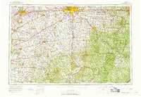
~ Columbus OH topo map, 1:250000 scale, 1 X 2 Degree, Historical, 1967, updated 1969
Columbus, Ohio, USGS topographic map dated 1967.
Includes geographic coordinates (latitude and longitude). This topographic map is suitable for hiking, camping, and exploring, or framing it as a wall map.
Printed on-demand using high resolution imagery, on heavy weight and acid free paper, or alternatively on a variety of synthetic materials.
Topos available on paper, Waterproof, Poly, or Tyvek. Usually shipping rolled, unless combined with other folded maps in one order.
- Product Number: USGS-5321586
- Free digital map download (high-resolution, GeoPDF): Columbus, Ohio (file size: 17 MB)
- Map Size: please refer to the dimensions of the GeoPDF map above
- Weight (paper map): ca. 55 grams
- Map Type: POD USGS Topographic Map
- Map Series: HTMC
- Map Verison: Historical
- Cell ID: 68727
- Scan ID: 224523
- Imprint Year: 1969
- Woodland Tint: Yes
- Aerial Photo Year: 1960
- Field Check Year: 1967
- Survey Year: 1966
- Datum: NAD27
- Map Projection: Universal Transverse Mercator
- Map published by United States Geological Survey
- Map Language: English
- Scanner Resolution: 600 dpi
- Map Cell Name: Columbus
- Grid size: 1 X 2 Degree
- Date on map: 1967
- Map Scale: 1:250000
- Geographical region: Ohio, United States
Neighboring Maps:
All neighboring USGS topo maps are available for sale online at a variety of scales.
Spatial coverage:
Topo map Columbus, Ohio, covers the geographical area associated the following places:
- Rockhouse (historical) - Rock Springs - Oak Park - Oakthorpe - Cromley (historical) - East Millersport - West Logan - Millport - Hamburg (historical) - Rock Way - Woodlyn - Heritage Glen - Van Meter - Bowersville - Darbydale - Hilliard Green - Griffith (historical) - Rolling Terrace Mobile Home Park - Dodo - Kozy Corners - Brooks Edge - Chrisman - Saltillo - Robbins (historical) - Robtown - Thurston - Belleview Heights - Lakeside - Poplar Grove - Salem Center - Brookside Park Mobile Home Park - Millers (historical) - Fullview Heights - New Vienna - Asbury (historical) - Whites - Kachelmacher (historical) - Cordle Mobile Home Park - Walser - Oakwood Acres - Robs Trailer Park - Ray - Dillon Falls - Zeal (historical) - Russells - Hawthorne Woods - Lake Darby - Windy Acres - Union Furnace - Dorchester Green - Jasper - Chapel Hill - Glencoe Estates - Barretts Mills - Winchester Lakes - Amsterdam - Green Hedges - Wilkesville - Bobo - Manara - McKays - Ironspot - Sunnyland - Wagon Wheel Mobile Home Park - Chestnut Farms - Washington Court House - Shackleton - Allensville - Pleasant Grove - Lyndon - Big Walnut (historical) - Obetz - Hope - Schrader - Northwood - New Rome - Markley (historical) - Liars Corner - Ratchford - Eustis (historical) - Edgewood Farms - Lake Darby Estates - Metzger - Pursell (historical) - Wrightville - Fairview - Conway Addition - Terra Cella Manor - Madison Lake - Oakfield - Monday - Mulga - Emerald - Avalon Heights - Winona (historical) - Greenland - Cedar Hills - Glenchester - La Mar Heights - Luttleton (historical)
- Map Area ID: AREA4039-84-82
- Northwest corner Lat/Long code: USGSNW40-84
- Northeast corner Lat/Long code: USGSNE40-82
- Southwest corner Lat/Long code: USGSSW39-84
- Southeast corner Lat/Long code: USGSSE39-82
- Northern map edge Latitude: 40
- Southern map edge Latitude: 39
- Western map edge Longitude: -84
- Eastern map edge Longitude: -82


