
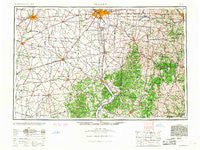
~ Columbus OH topo map, 1:250000 scale, 1 X 2 Degree, Historical, 1961
Columbus, Ohio, USGS topographic map dated 1961.
Includes geographic coordinates (latitude and longitude). This topographic map is suitable for hiking, camping, and exploring, or framing it as a wall map.
Printed on-demand using high resolution imagery, on heavy weight and acid free paper, or alternatively on a variety of synthetic materials.
Topos available on paper, Waterproof, Poly, or Tyvek. Usually shipping rolled, unless combined with other folded maps in one order.
- Product Number: USGS-5321582
- Free digital map download (high-resolution, GeoPDF): Columbus, Ohio (file size: 16 MB)
- Map Size: please refer to the dimensions of the GeoPDF map above
- Weight (paper map): ca. 55 grams
- Map Type: POD USGS Topographic Map
- Map Series: HTMC
- Map Verison: Historical
- Cell ID: 68727
- Scan ID: 224520
- Woodland Tint: Yes
- Aerial Photo Year: 1940
- Datum: Unstated
- Map Projection: Transverse Mercator
- Map published by United States Geological Survey
- Map published by United States Army Corps of Engineers
- Map published by United States Army
- Map Language: English
- Scanner Resolution: 600 dpi
- Map Cell Name: Columbus
- Grid size: 1 X 2 Degree
- Date on map: 1961
- Map Scale: 1:250000
- Geographical region: Ohio, United States
Neighboring Maps:
All neighboring USGS topo maps are available for sale online at a variety of scales.
Spatial coverage:
Topo map Columbus, Ohio, covers the geographical area associated the following places:
- Grosvenor - Riceville (historical) - South Perry - Jefferson Estates - Rock Way - Briggsdale - Rittenours - Fairview (historical) - Coalgate - Brookgrove - Hoover Crossing - Muskingum (historical) - Darwin - Van Meter - New Lexington - Mount Sinai - North Uniontown - Alkire Place - Fairfield Beach - Matville - Sullivants (historical) - Lehman Estates - Hamley Run - R and J Mobile Home Park - Farmers - Ziontown - Rolfe Mobile Home Park - The Crossing At Grants Run - Fairview - Saint Paul - Grooms - Hanford - Villas At Charleston Lake - High Meadow - Ashton Crossing - Crawford Farms - Idaho - Burtonville - Lincoln Village - Minerton - Whipstown - Quaker Hill - Darlington - Blanchester - Pleasant Hill - Meadowbrook - Henrys Trailer Court - Rockbridge - Maxville - Slough - Concord Park - Mount Perry - Prospect - Webertown - Haughn Glen - Greencastle - Cunningham - Hamilton Meadows - Outville - Octa - Dillon View - Summit (historical) - Valley View - Bourneville - Elizabeth - Chauncey - Morgantown - Klocks Crossing - South Zanesville - Suburban Village - Grove City Heights - Coonville - Seymoreville (historical) - Buchanan - Pickerington - Brice - Athens - Beals - Snyderville - Harding Heights - Zimmer - Miracle Mile - Cawthorn - Hillsboro - Armitage - Hoboken (historical) - Durgan - Hoover Park - Oakfield - Randall Terrace - Meadow Grove Estates - Middleport - Lake View Heights - Royal - Brice Meadows - May Hill - Edgewood Farms - Latham - Harwood - Sorg (historical)
- Map Area ID: AREA4039-84-82
- Northwest corner Lat/Long code: USGSNW40-84
- Northeast corner Lat/Long code: USGSNE40-82
- Southwest corner Lat/Long code: USGSSW39-84
- Southeast corner Lat/Long code: USGSSE39-82
- Northern map edge Latitude: 40
- Southern map edge Latitude: 39
- Western map edge Longitude: -84
- Eastern map edge Longitude: -82


