
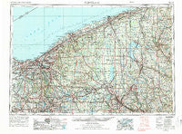
~ Cleveland OH topo map, 1:250000 scale, 1 X 2 Degree, Historical, 1956, updated 1988
Cleveland, Ohio, USGS topographic map dated 1956.
Includes geographic coordinates (latitude and longitude). This topographic map is suitable for hiking, camping, and exploring, or framing it as a wall map.
Printed on-demand using high resolution imagery, on heavy weight and acid free paper, or alternatively on a variety of synthetic materials.
Topos available on paper, Waterproof, Poly, or Tyvek. Usually shipping rolled, unless combined with other folded maps in one order.
- Product Number: USGS-5321578
- Free digital map download (high-resolution, GeoPDF): Cleveland, Ohio (file size: 18 MB)
- Map Size: please refer to the dimensions of the GeoPDF map above
- Weight (paper map): ca. 55 grams
- Map Type: POD USGS Topographic Map
- Map Series: HTMC
- Map Verison: Historical
- Cell ID: 68719
- Scan ID: 226422
- Imprint Year: 1988
- Woodland Tint: Yes
- Aerial Photo Year: 1972
- Edit Year: 1972
- Field Check Year: 1956
- Datum: Unstated
- Map Projection: Transverse Mercator
- Map published by United States Geological Survey
- Map published by: Military, Other
- Map Language: English
- Scanner Resolution: 600 dpi
- Map Cell Name: Cleveland
- Grid size: 1 X 2 Degree
- Date on map: 1956
- Map Scale: 1:250000
- Geographical region: Ohio, United States
Neighboring Maps:
All neighboring USGS topo maps are available for sale online at a variety of scales.
Spatial coverage:
Topo map Cleveland, Ohio, covers the geographical area associated the following places:
- Braceville Ridge - Leesburg - Saegertown - Lakeside Terrace - Black Horse - White House Park - Petersburg - Bradley Woods - Highland Hills - Eagle Trailer Park - London - Euclid Beach Mobile Home Park - Lakemore - Chairmans Rowe - Oakwood - Wayland - Ghent - Carmona - McCoys Corners - Kremis - Mosiertown - Minnis Corner - Columbia Station - North Kingsville - Plymouth - Moran - Cedar Corners - Little Mountain - Plaza Trailer Court - Hidden Acres - Keans (historical) - Glenmore Estates - Bunkers Corners - Purdys Trailer Park - Salow Corners - Mecca - Claridon - Harbor - Trumbull - Camp Luther - Bushnell - Saybrook-on-the-lake - Alexander - Breckenridge - Hamlet Park - Taylor Mobile Home Park - Salem - Fowlers Mill - Mareddy Estates - Volant - Woodhill Homes - Greenfield - Sodom - Edinburg - Big Italy - Ohio City - Harbor - Richfield Heights - Lake Park Estates - Dover Bay Estates - Oakland - Seville - Oakwood - Rock Falls Park - Cornelion - Howland Mobile Home Park - Lester - Stoneville - Driftwood - Hillsville - Old Chinatown - Indian Springs Mobile Home Park - Sunol - Fairport Harbor - Popes Corners - Auburn Center - Redmond - Farrell - Pritchard - Rustic Pine Mobile Home Park - Sunset Beach - Yale - Halls Corners - Linndale - Navy Park Housing Project (historical) - Eastbrook - Gould - Cool Spring - Madison-on-the-Lake - Bosworth (historical) - Windsor - Venango - Leavittsburg - West Park Ridge Estates - Columbia Park - Rocky River - Painesville on-the-Lake - Middleboro - Gresham - The Willows
- Map Area ID: AREA4241-82-80
- Northwest corner Lat/Long code: USGSNW42-82
- Northeast corner Lat/Long code: USGSNE42-80
- Southwest corner Lat/Long code: USGSSW41-82
- Southeast corner Lat/Long code: USGSSE41-80
- Northern map edge Latitude: 42
- Southern map edge Latitude: 41
- Western map edge Longitude: -82
- Eastern map edge Longitude: -80


