
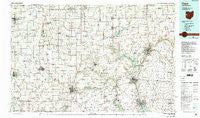
~ Piqua OH topo map, 1:100000 scale, 30 X 60 Minute, Historical, 1986, updated 1992
Piqua, Ohio, USGS topographic map dated 1986.
Includes geographic coordinates (latitude and longitude). This topographic map is suitable for hiking, camping, and exploring, or framing it as a wall map.
Printed on-demand using high resolution imagery, on heavy weight and acid free paper, or alternatively on a variety of synthetic materials.
Topos available on paper, Waterproof, Poly, or Tyvek. Usually shipping rolled, unless combined with other folded maps in one order.
- Product Number: USGS-5321528
- Free digital map download (high-resolution, GeoPDF): Piqua, Ohio (file size: 21 MB)
- Map Size: please refer to the dimensions of the GeoPDF map above
- Weight (paper map): ca. 55 grams
- Map Type: POD USGS Topographic Map
- Map Series: HTMC
- Map Verison: Historical
- Cell ID: 68155
- Scan ID: 228053
- Imprint Year: 1992
- Woodland Tint: Yes
- Visual Version Number: 1
- Photo Inspection Year: 1989
- Aerial Photo Year: 1989
- Edit Year: 1986
- Datum: NAD27
- Map Projection: Universal Transverse Mercator
- Map published by United States Geological Survey
- Map Language: English
- Scanner Resolution: 600 dpi
- Map Cell Name: Piqua
- Grid size: 30 X 60 Minute
- Date on map: 1986
- Map Scale: 1:100000
- Geographical region: Ohio, United States
Neighboring Maps:
All neighboring USGS topo maps are available for sale online at a variety of scales.
Spatial coverage:
Topo map Piqua, Ohio, covers the geographical area associated the following places:
- Sharpsburg - Maplewood - Edgewater - Nineveh - Jimtown (historical) - Premwood - Abe - Carriage Crossing - Eastwood Mobile Home Estates - Plattsville - West Lake Village - Conover - Nashville - Harrisville - Painter Creek - Brice - Hickory Dell Estates - Hunchberger Corners - Frenchtown - Kensington - Fort Loramie - Westbrook - Osterholt Mobile Home Park - Brook Park North - Brookside - Conwood Estates - Ballou - Saint Patrick - Alcony - Deerfield - Cassella - Lynn - North Star - Valentine (historical) - Woodlawn - Whitackers Court - Strakers (historical) - Byrds Mobile Home Park - Union City Mobile Home Park - Saint Johns - Rossville - Fort Recovery - Palestine - Willowdell - Dawson - Christopher Northbrook Mobile Home Park - Yorkshire - Colonial Mobile Home Park - Hawk Cove - Union Corners - Portland - Pleasant Hill - Saint Joseph - Cosmos - Stony Ridge - Mount Jefferson - Wildcat Woods Estates - Crete - Wakefield - Pleasant View - Stonebridge Meadows - New Knoxville - Windridge Place - Fletcher - Versailles - Buckhorn Corner - Macedon - Wendelin - Delisle - Sampson (historical) - Salem - Saratoga - Maplecrest - Pemberton - Oakmont Creek - Landis - Fairfield - Morris Trailer Park - Union City - Bartonia - Laurel Creek - College Corner - Noble - Culbertson Heights - Westchester - Stanfield Place - Abbottsville - Coletown - Landin Park - Earls Island - Heritage Hill - Tampico - Egypt - Meadowrun - Hardin - Steel Point - Union City - Bloomer - Broad Acres - Nottingham
- Map Area ID: AREA40.540-85-84
- Northwest corner Lat/Long code: USGSNW40.5-85
- Northeast corner Lat/Long code: USGSNE40.5-84
- Southwest corner Lat/Long code: USGSSW40-85
- Southeast corner Lat/Long code: USGSSE40-84
- Northern map edge Latitude: 40.5
- Southern map edge Latitude: 40
- Western map edge Longitude: -85
- Eastern map edge Longitude: -84


