
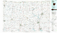
~ Piqua OH topo map, 1:100000 scale, 30 X 60 Minute, Historical, 1986, updated 1986
Piqua, Ohio, USGS topographic map dated 1986.
Includes geographic coordinates (latitude and longitude). This topographic map is suitable for hiking, camping, and exploring, or framing it as a wall map.
Printed on-demand using high resolution imagery, on heavy weight and acid free paper, or alternatively on a variety of synthetic materials.
Topos available on paper, Waterproof, Poly, or Tyvek. Usually shipping rolled, unless combined with other folded maps in one order.
- Product Number: USGS-5321524
- Free digital map download (high-resolution, GeoPDF): Piqua, Ohio (file size: 15 MB)
- Map Size: please refer to the dimensions of the GeoPDF map above
- Weight (paper map): ca. 55 grams
- Map Type: POD USGS Topographic Map
- Map Series: HTMC
- Map Verison: Historical
- Cell ID: 68155
- Scan ID: 228051
- Imprint Year: 1986
- Aerial Photo Year: 1983
- Edit Year: 1986
- Datum: NAD27
- Map Projection: Universal Transverse Mercator
- Planimetric: Yes
- Map published by United States Geological Survey
- Map Language: English
- Scanner Resolution: 600 dpi
- Map Cell Name: Piqua
- Grid size: 30 X 60 Minute
- Date on map: 1986
- Map Scale: 1:100000
- Geographical region: Ohio, United States
Neighboring Maps:
All neighboring USGS topo maps are available for sale online at a variety of scales.
Spatial coverage:
Topo map Piqua, Ohio, covers the geographical area associated the following places:
- Westridge - Anna - Overlook Trailer Park - Port Jefferson - Botkins - Green Villa Mobile Park - Northbrook - Spartanburg - Palestine - Union City - Westhaven - Northumberland (historical) - Tawawa - Staunton - Poplar Ridge - Osgood - Sidney - Laurel Creek - Portland - Willowdell - Pleasant Hill - Deerfield - New Bremen - Hetzlerville (historical) - Recks Trailer Park - Olwine Mobile Home Park - Saint Peter - Pleasant View - Salamonia - Eastwood Mobile Home Estates - Filburns Island - Meadowlawn - Broadway Mobile Court - Covington - Meyers (historical) - Russia - Stelvideo - Fort Jefferson - Spirk Mobile Home Park - Oran - Cassella - Bloomingport - Clayton - Fort Loramie - Pleasant Ridge - New Knoxville - Christopher Northbrook Mobile Home Park - North Dayton - Woodlawn - Landis - Buckeye Terrace - West Lake Village - Red River - Mount Jefferson - Sampson (historical) - Hegemanns Landing - Maria Stein - Ansonia - Strakers (historical) - Byrds Mobile Home Park - Park Place - Rossburg - Morris Trailer Park - Delisle - Noble - Frys Corners - Sugar Grove - Bellfountain - Kirkwood - Lehmkuhl Landing - Monterey - Haysville Corner - Saint Johns - Broad Acres - Frenchtown - Midway - Fletcher - Sodom (historical) - Hardin - Pemberton - Oakmont Creek - Boundary City - Laine Trailer Park - Meadowrun - Hageman (historical) - Gettysburg - Delvin (historical) - Eldean - Coletown - Beamsville - Sharpsburg - Bradford - New Lisbon - Montra - North Jacksonville - Bears Mill - Cloverdale - Westlake Village - Philothea - Wakefield
- Map Area ID: AREA40.540-85-84
- Northwest corner Lat/Long code: USGSNW40.5-85
- Northeast corner Lat/Long code: USGSNE40.5-84
- Southwest corner Lat/Long code: USGSSW40-85
- Southeast corner Lat/Long code: USGSSE40-84
- Northern map edge Latitude: 40.5
- Southern map edge Latitude: 40
- Western map edge Longitude: -85
- Eastern map edge Longitude: -84


