
~ Mansfield OH topo map, 1:100000 scale, 30 X 60 Minute, Historical, 1986, updated 1986
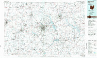
Mansfield, Ohio, USGS topographic map dated 1986.
Includes geographic coordinates (latitude and longitude). This topographic map is suitable for hiking, camping, and exploring, or framing it as a wall map.
Printed on-demand using high resolution imagery, on heavy weight and acid free paper, or alternatively on a variety of synthetic materials.
Topos available on paper, Waterproof, Poly, or Tyvek. Usually shipping rolled, unless combined with other folded maps in one order.
- Product Number: USGS-5321518
- Free digital map download (high-resolution, GeoPDF): Mansfield, Ohio (file size: 16 MB)
- Map Size: please refer to the dimensions of the GeoPDF map above
- Weight (paper map): ca. 55 grams
- Map Type: POD USGS Topographic Map
- Map Series: HTMC
- Map Verison: Historical
- Cell ID: 72645
- Scan ID: 225947
- Imprint Year: 1986
- Aerial Photo Year: 1981
- Edit Year: 1986
- Datum: NAD27
- Map Projection: Universal Transverse Mercator
- Planimetric: Yes
- Map published by United States Geological Survey
- Map Language: English
- Scanner Resolution: 600 dpi
- Map Cell Name: Mansfield
- Grid size: 30 X 60 Minute
- Date on map: 1986
- Map Scale: 1:100000
- Geographical region: Ohio, United States
Neighboring Maps:
All neighboring USGS topo maps are available for sale online at a variety of scales.
Spatial coverage:
Topo map Mansfield, Ohio, covers the geographical area associated the following places:
- Welcome - McZena - Iberia - Shelby - Alta - West Shore Cottage Area - Williamsport - Spring Grove (historical) - Blachleyville - Climax - Shelby Mobile Home Park - Ganges - Meadowood Estates Mobile Home Park - Dale Avenue Mobile Home Park - Weir Mobile Home Park - Pavonia - Roseland - Little Washington - Cesarea - Cedar Valley - Mohicanville - Widowville - Martel - Auburn Center - Shiloh - Mobile Manor Park - New Washington - Vernon Junction - Beech (historical) - Lakeland Beach - Pin Oak Mobile Home Park - Hastings - Ontario - Jugs Corners - Capri Mobile Home Park - Northwood Estates - Greer - Jelloway - West Liberty - Centerville - Sites Lake Cottage Area - Claridon - Bangorville - Lake Silverstone Mobile Home Park - Yacht Point Cottage Area - Fleming Falls - Springville - McKay - New Pittsburgh - Kellker (historical) - North Robinson - Linden Park - New Winchester - Leesville - Treaton - Biddle (historical) - Ashfield Estates Mobile Home Park - Forest Hills Mobile Park - Westview Mobile Home Park - Lucas - Clearfork Mobile Home Park - Culler Mill - Darlington - Brandywine - Carpenters Mobile Home Park - Saint Johns (historical) - Hill Street Mobile Home Park - Craigton - Jackson - Nankin - Reedsburg - Big Prairie - Maple Grove Park - Palmyra - Four Corners - Hayesville - Waterford Glen - Spellacy - Trailerville Mobile Home Park - Lincoln Heights - East Mansfield - Shenandoah - Savannah - Sunnyview - South Peninsula Cottage Area - River Edge Mobile Park - Denmark - Russell - Armstrong - Lockhart - Lattasburg - Melco - Batemantown - Pinecrest Mobile Home Park - Amoy - Hanley Village - Plymouth - Forest (historical) - Paradise Hill - Five Corners
- Map Area ID: AREA4140.5-83-82
- Northwest corner Lat/Long code: USGSNW41-83
- Northeast corner Lat/Long code: USGSNE41-82
- Southwest corner Lat/Long code: USGSSW40.5-83
- Southeast corner Lat/Long code: USGSSE40.5-82
- Northern map edge Latitude: 41
- Southern map edge Latitude: 40.5
- Western map edge Longitude: -83
- Eastern map edge Longitude: -82


