
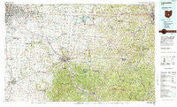
~ Lancaster OH topo map, 1:100000 scale, 30 X 60 Minute, Historical, 1984, updated 1985
Lancaster, Ohio, USGS topographic map dated 1984.
Includes geographic coordinates (latitude and longitude). This topographic map is suitable for hiking, camping, and exploring, or framing it as a wall map.
Printed on-demand using high resolution imagery, on heavy weight and acid free paper, or alternatively on a variety of synthetic materials.
Topos available on paper, Waterproof, Poly, or Tyvek. Usually shipping rolled, unless combined with other folded maps in one order.
- Product Number: USGS-5321504
- Free digital map download (high-resolution, GeoPDF): Lancaster, Ohio (file size: 30 MB)
- Map Size: please refer to the dimensions of the GeoPDF map above
- Weight (paper map): ca. 55 grams
- Map Type: POD USGS Topographic Map
- Map Series: HTMC
- Map Verison: Historical
- Cell ID: 67814
- Scan ID: 225543
- Imprint Year: 1985
- Woodland Tint: Yes
- Aerial Photo Year: 1978
- Edit Year: 1984
- Datum: NAD27
- Map Projection: Universal Transverse Mercator
- Map published by United States Geological Survey
- Map Language: English
- Scanner Resolution: 600 dpi
- Map Cell Name: Lancaster
- Grid size: 30 X 60 Minute
- Date on map: 1984
- Map Scale: 1:100000
- Geographical region: Ohio, United States
Neighboring Maps:
All neighboring USGS topo maps are available for sale online at a variety of scales.
Spatial coverage:
Topo map Lancaster, Ohio, covers the geographical area associated the following places:
- Leistville - Pinecrest Estates - Summerland Beach - Amanda - Lyonsdale (historical) - Sharp (historical) - Columbus - Harding Heights - Brighton - Chapel Hill - Moscow (historical) - Carrington - Briarcliff - Rose Hill Heights - Lakeside - Straitsville - Congo - Wacker Heights - Brice Meadows - Jefferson Estates - Waterloo - Valley Crossing - Meadow Farm - Little Chicago - Kramers Addition - Murray City - Glass Rock - Tarhe Town (historical) - Hemlock - Pleasant Hill - Thornville - Luray - Pickerington - Rose Farm - Yost - Griffith (historical) - Yogi's Mobile Home Park - Hamburg (historical) - Sand Run Junction - Cedar Hill - Terrace - Brigglesville - Essex Place - Pine Ridge - Jefferson Woods - Ashton Crossing - Drinkle - Outville - Kensington Glen - Washington Meadows - Old Gore - Columbia Center - Big Walnut (historical) - Wesley - Eastmoor Subdivision - West Logan - Kingswood Farms - San Toy - Village At Shannon Green - White Oak Park - Jefferson - Gray (historical) - Bixford Green - Milo - Coalgate - Geneva - Motts Place - Fairfield Beach - Greendale - Hatfield - Roseland - Carbon Hill - Gore - Opera (historical) - Glenford - Pine Grove (historical) - Asbury (historical) - Ashville - Lehman Estates - Fleatown - Pine Lake Estates - Hollywood by the Lake - Westwood - Royalton - Voorheis (historical) - Slate Ridge Estates - Roberts - Winona (historical) - New Salem - Misco - Joe (historical) - Russells - Hoboken (historical) - Glouster - Taylor Mobile Home Park - Consol (historical) - Monday Creek Junction - Mainsville - Clarksville - Thornport
- Map Area ID: AREA4039.5-83-82
- Northwest corner Lat/Long code: USGSNW40-83
- Northeast corner Lat/Long code: USGSNE40-82
- Southwest corner Lat/Long code: USGSSW39.5-83
- Southeast corner Lat/Long code: USGSSE39.5-82
- Northern map edge Latitude: 40
- Southern map edge Latitude: 39.5
- Western map edge Longitude: -83
- Eastern map edge Longitude: -82


