
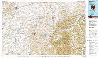
~ Hillsboro OH topo map, 1:100000 scale, 30 X 60 Minute, Historical, 1986, updated 1990
Hillsboro, Ohio, USGS topographic map dated 1986.
Includes geographic coordinates (latitude and longitude). This topographic map is suitable for hiking, camping, and exploring, or framing it as a wall map.
Printed on-demand using high resolution imagery, on heavy weight and acid free paper, or alternatively on a variety of synthetic materials.
Topos available on paper, Waterproof, Poly, or Tyvek. Usually shipping rolled, unless combined with other folded maps in one order.
- Product Number: USGS-5321500
- Free digital map download (high-resolution, GeoPDF): Hillsboro, Ohio (file size: 25 MB)
- Map Size: please refer to the dimensions of the GeoPDF map above
- Weight (paper map): ca. 55 grams
- Map Type: POD USGS Topographic Map
- Map Series: HTMC
- Map Verison: Historical
- Cell ID: 67670
- Scan ID: 226176
- Imprint Year: 1990
- Woodland Tint: Yes
- Aerial Photo Year: 1985
- Edit Year: 1986
- Datum: NAD27
- Map Projection: Universal Transverse Mercator
- Map published by United States Geological Survey
- Map Language: English
- Scanner Resolution: 600 dpi
- Map Cell Name: Hillsboro
- Grid size: 30 X 60 Minute
- Date on map: 1986
- Map Scale: 1:100000
- Geographical region: Ohio, United States
Neighboring Maps:
All neighboring USGS topo maps are available for sale online at a variety of scales.
Spatial coverage:
Topo map Hillsboro, Ohio, covers the geographical area associated the following places:
- Little Center - South Branch Trailer Court - Lincolnville - Pleasant Valley - Sabina Manor Estates - Babingtons Trailer Park - Latham - Stringtown - Idaho - Pirates Cove - Wilmington - Bridges - Belfast - Sulphur Lick - Eastwood - Spargursville - J D Smith Mobile Home Park - Burtonville - Riverview Mobile Home Park - Grooms Mobile Home Park - Riviera Park - Reesville - Morgantown - Melvin - Peck - Buford - Dodsonville - Elmville - White's Mobile Home Park - Knockemstiff - Shackleton - Vera Cruz - Brown County Mobile Home Park - Rocky Fork Point - Fairview - Ferristown - Russell - Lattaville - Smoky Corners - Westboro - Stringtown - Storms - Moler Mobile Home Park - Oakland - Hickoryville - Hillsboro Mobile Home Park - Newfain - Blanchester - East Danville - Newingburg (historical) - Barretts Mills - Sicily (historical) - Austin - Emerald - Sardinia - Allensburg - East Monroe - Sargents - Fallsville (historical) - Boyds - New Martinsburg - Marshall - Piketon Trailer Court - Brownstown (historical) - Plano - Midland - Gall (historical) - Coon Crossing - Georgetown - Emerald Pines Mobile Home Park - Slate Mills - White Oak - Highland Station - Pleasant Valley - Maple Grove - Poplar Grove - Sligo - Lapperell - Jonesboro - Bloom Rose (historical) - Lighthouse Trailer Park - Boston - Lynwood Terrace - Summithill - Bodman - Kincaid Springs - Good Hope - Jasper - Pleasant Grove - Luttleton (historical) - Gibson Trailer Park - Minnehan Bend - Jessup - Country Home Trailer Park - Byington - Lake White Mobile Home Park - Thrifton - Rolfe Mobile Home Park - Prospect - Dills
- Map Area ID: AREA39.539-84-83
- Northwest corner Lat/Long code: USGSNW39.5-84
- Northeast corner Lat/Long code: USGSNE39.5-83
- Southwest corner Lat/Long code: USGSSW39-84
- Southeast corner Lat/Long code: USGSSE39-83
- Northern map edge Latitude: 39.5
- Southern map edge Latitude: 39
- Western map edge Longitude: -84
- Eastern map edge Longitude: -83


