
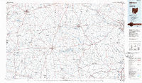
~ Hillsboro OH topo map, 1:100000 scale, 30 X 60 Minute, Historical, 1986, updated 1986
Hillsboro, Ohio, USGS topographic map dated 1986.
Includes geographic coordinates (latitude and longitude). This topographic map is suitable for hiking, camping, and exploring, or framing it as a wall map.
Printed on-demand using high resolution imagery, on heavy weight and acid free paper, or alternatively on a variety of synthetic materials.
Topos available on paper, Waterproof, Poly, or Tyvek. Usually shipping rolled, unless combined with other folded maps in one order.
- Product Number: USGS-5321498
- Free digital map download (high-resolution, GeoPDF): Hillsboro, Ohio (file size: 15 MB)
- Map Size: please refer to the dimensions of the GeoPDF map above
- Weight (paper map): ca. 55 grams
- Map Type: POD USGS Topographic Map
- Map Series: HTMC
- Map Verison: Historical
- Cell ID: 67670
- Scan ID: 226175
- Imprint Year: 1986
- Aerial Photo Year: 1985
- Edit Year: 1986
- Datum: NAD27
- Map Projection: Universal Transverse Mercator
- Planimetric: Yes
- Map published by United States Geological Survey
- Map Language: English
- Scanner Resolution: 600 dpi
- Map Cell Name: Hillsboro
- Grid size: 30 X 60 Minute
- Date on map: 1986
- Map Scale: 1:100000
- Geographical region: Ohio, United States
Neighboring Maps:
All neighboring USGS topo maps are available for sale online at a variety of scales.
Spatial coverage:
Topo map Hillsboro, Ohio, covers the geographical area associated the following places:
- Louden - Emerald - McMahan's Mobile Home Park - Randall Terrace - Bethel - Smoky Corners - Jasper - Humboldt - Taylorsville - Lyndon - Stringtown - Henrys Trailer Court - Greenland - Fallsville (historical) - Spargursville - Rolfe Mobile Home Park - Harriett - Fairview - Elmville - Pleasant Valley - Rocky Fork Point - Pleasant Valley - Vandervorts Corners - Bridges - Greenbush - New Vienna - Memphis - Latham - Sicily (historical) - View (historical) - Honolulu (historical) - Riverview Mobile Home Park - Austin - Lattaville - Town And Country Estates - Sligo - Mount Orab - Marshall - North Uniontown - Westboro - Burtonville - Sugar Tree Ridge - Careytown - Pricetown - Belfast - Clinton - Knockemstiff - Highland Holiday - Blair Modern Trailer Court - Idaho - Daleyville - Tennyson - R and J Mobile Home Park - Brown County Mobile Home Park - Turkey - Sargents - McCoppin Mill - Mowrystown - Nipgen - Sabina Manor Estates - Kincaid Springs - Cuba - Coon Crossing - Emerald Pines Mobile Home Park - Ebush (historical) - Hollowtown - Country Home Trailer Park - Lynchburg - Winkle - Russell - Ferristown - Elm Grove - Cynthiana - Sorg (historical) - Gall (historical) - Kimballs Mobile Home Park - Bardwell - Lynwood Terrace - Piketon - Good Hope - Hoagland - Hatch - Vera Cruz - Sulphur Lick - Fairview - Yankeetown - Andersonville - Buford - Hills (historical) - Waverly Gables - Barretts Mills - Slate Mills - Pansy - Berrysville - White Oak - Harris - Blanchester Mobile Home Park - Lake View Heights - Gist Settlement - Bainbridge
- Map Area ID: AREA39.539-84-83
- Northwest corner Lat/Long code: USGSNW39.5-84
- Northeast corner Lat/Long code: USGSNE39.5-83
- Southwest corner Lat/Long code: USGSSW39-84
- Southeast corner Lat/Long code: USGSSE39-83
- Northern map edge Latitude: 39.5
- Southern map edge Latitude: 39
- Western map edge Longitude: -84
- Eastern map edge Longitude: -83


