
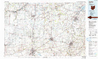
~ Findlay OH topo map, 1:100000 scale, 30 X 60 Minute, Historical, 1986, updated 1992
Findlay, Ohio, USGS topographic map dated 1986.
Includes geographic coordinates (latitude and longitude). This topographic map is suitable for hiking, camping, and exploring, or framing it as a wall map.
Printed on-demand using high resolution imagery, on heavy weight and acid free paper, or alternatively on a variety of synthetic materials.
Topos available on paper, Waterproof, Poly, or Tyvek. Usually shipping rolled, unless combined with other folded maps in one order.
- Product Number: USGS-5321496
- Free digital map download (high-resolution, GeoPDF): Findlay, Ohio (file size: 18 MB)
- Map Size: please refer to the dimensions of the GeoPDF map above
- Weight (paper map): ca. 55 grams
- Map Type: POD USGS Topographic Map
- Map Series: HTMC
- Map Verison: Historical
- Cell ID: 76796
- Scan ID: 226075
- Imprint Year: 1992
- Woodland Tint: Yes
- Photo Inspection Year: 1990
- Aerial Photo Year: 1983
- Edit Year: 1986
- Datum: NAD27
- Map Projection: Universal Transverse Mercator
- Map published by United States Geological Survey
- Map Language: English
- Scanner Resolution: 600 dpi
- Map Cell Name: Findlay
- Grid size: 30 X 60 Minute
- Date on map: 1986
- Map Scale: 1:100000
- Geographical region: Ohio, United States
Neighboring Maps:
All neighboring USGS topo maps are available for sale online at a variety of scales.
Spatial coverage:
Topo map Findlay, Ohio, covers the geographical area associated the following places:
- Hillside Pines Mobile Home Park - Northridge Estates - Bloomville - Tousaint (historical) - Cygnet - Denver - Jerry City - Mortimer - Riverview Trailer Court - Fourmile House Corner - Oakdale (historical) - Perrysburg Estates Mobile Home Park - Gibsonburg - Lowell - Bays - Linden (historical) - Mermill - Dunbridge - Williamsburg-On-The-River - Shawtown - Belmore - Winters Station - Luckey - Portage Center - Cromers - Haney (historical) - Texas - Asbury Hills - Westhope - Busy Corners - Grelton - Clearwater Trailer Park - Galatea - Center - Portage - Farnham (historical) - Madison Addition - Berch Terrace Mobile Home Park - Swander - Deer Ridge Mobile Home Park - Fremont Trailer Park - Weston Trailer Court - Bairdstown - Mid City Mobile Homes - Milton Center - Fenton (historical) - Fremont - Sunset Trailer Court - Erlin - Fostoria Mobile Estates - Nyes Mobile Home Park - Muncie Hollow - Oil Station - Shorewood Village - Colton - Green Springs - Springville - Kingsway - Risingsun - Gibsonburg Junction (historical) - Trombley - Sugar Ridge - North Pointe Place Mobile Home Park - Neapolis - Stearns Crest - New Rochester - Bettsville - Wightmans Grove - Pelton Mobile Home Park - The Village - Miltonville (historical) - Village Green Mobile Home Park - Benton Ridge - Dowling - Elmore - West Park - Chateau East - Eastland Acres Mobile Home Park - Raineys (historical) - Catalpa Grove - Lewisville (historical) - Amsden - Tondagamies Village (historical) - Burgoon - Digby - Bassett (historical) - Rehoboth - Bailey - Hatton - Findlay - Schlegels Grove - Pemberville - Great Lakes Village - Rudolph - Woodville - Republic - Rollersville - Hull Prairie - Mount Gilead - Eagle Landing Mobile Home Park
- Map Area ID: AREA41.541-84-83
- Northwest corner Lat/Long code: USGSNW41.5-84
- Northeast corner Lat/Long code: USGSNE41.5-83
- Southwest corner Lat/Long code: USGSSW41-84
- Southeast corner Lat/Long code: USGSSE41-83
- Northern map edge Latitude: 41.5
- Southern map edge Latitude: 41
- Western map edge Longitude: -84
- Eastern map edge Longitude: -83


