
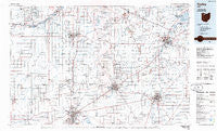
~ Findlay OH topo map, 1:100000 scale, 30 X 60 Minute, Historical, 1986, updated 1986
Findlay, Ohio, USGS topographic map dated 1986.
Includes geographic coordinates (latitude and longitude). This topographic map is suitable for hiking, camping, and exploring, or framing it as a wall map.
Printed on-demand using high resolution imagery, on heavy weight and acid free paper, or alternatively on a variety of synthetic materials.
Topos available on paper, Waterproof, Poly, or Tyvek. Usually shipping rolled, unless combined with other folded maps in one order.
- Product Number: USGS-5321494
- Free digital map download (high-resolution, GeoPDF): Findlay, Ohio (file size: 16 MB)
- Map Size: please refer to the dimensions of the GeoPDF map above
- Weight (paper map): ca. 55 grams
- Map Type: POD USGS Topographic Map
- Map Series: HTMC
- Map Verison: Historical
- Cell ID: 76796
- Scan ID: 226074
- Imprint Year: 1986
- Aerial Photo Year: 1983
- Edit Year: 1986
- Datum: NAD27
- Map Projection: Universal Transverse Mercator
- Planimetric: Yes
- Map published by United States Geological Survey
- Map Language: English
- Scanner Resolution: 600 dpi
- Map Cell Name: Findlay
- Grid size: 30 X 60 Minute
- Date on map: 1986
- Map Scale: 1:100000
- Geographical region: Ohio, United States
Neighboring Maps:
All neighboring USGS topo maps are available for sale online at a variety of scales.
Spatial coverage:
Topo map Findlay, Ohio, covers the geographical area associated the following places:
- Pelton Mobile Home Park - Bascom - Six Points - Saint Nicholas (historical) - Frenchtown - Lemoyne - Arlington Woods - Deshler - Neapolis - Great Lakes Village - West Millgrove - Neowash (historical) - Leipsic Junction - Maurers Mobile Home Court - Swander - Olde Town Mobile Home Park - Williams Mobile Home Park - Cedar Tree Estates - Chateau East - Busy Corners - Tinney - Tiffin - Northridge Estates - Perrysburg Estates Mobile Home Park - Portage Center - North Ridgeville (historical) - Lindsey - Riverview Trailer Court - Maple Grove - Riverview Terrace Park - Eagle Landing Mobile Home Park - Leipsic - Cloverdale - Brookpark Estates - Otsego - Grelton - Fremont Trailer Park - Stearns Crest - Orchard Lane Trailer Court - Murphys - Haney (historical) - Bradner - Custar - Cromers - Fenton (historical) - South Findlay - Chase - Mortimer - Westgate Homes - Longley - Tontogany - Squires - Williamsburg-On-The-River - Lewisville (historical) - Clinton Mobile Home Court - Clearwater Trailer Park - Christy - Burgoon - Riverdale (historical) - Bowling Green - Denver - Townwood - Oil Station - New Riegel - Young's Colonial Acres - Farnham (historical) - Flechtner Heights - Kingsway - Elmore - Hull Prairie - Eastland Acres Mobile Home Park - Mermill - Green Creek - Ducat - Berwick - Cygnet - Republic - Wightmans Grove - Wingston - Hessville - Bloomville - Willow Haven Trailer Court - Hancock - Weston Trailer Court - Shawtown - The Village - Highland Park Estates - Berch Terrace Mobile Home Park - Caldwells Addition - Twin Maples Trailer Court - Portage - Eagleville - Rockaway - Sunset Trailer Court - Golden Gate Estates - Schlegels Grove - Havens - Green Springs - Grand Rapids - Melmore
- Map Area ID: AREA41.541-84-83
- Northwest corner Lat/Long code: USGSNW41.5-84
- Northeast corner Lat/Long code: USGSNE41.5-83
- Southwest corner Lat/Long code: USGSSW41-84
- Southeast corner Lat/Long code: USGSSE41-83
- Northern map edge Latitude: 41.5
- Southern map edge Latitude: 41
- Western map edge Longitude: -84
- Eastern map edge Longitude: -83


