
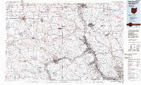
~ East Liverpool OH topo map, 1:100000 scale, 30 X 60 Minute, Historical, 1986, updated 1986
East Liverpool, Ohio, USGS topographic map dated 1986.
Includes geographic coordinates (latitude and longitude). This topographic map is suitable for hiking, camping, and exploring, or framing it as a wall map.
Printed on-demand using high resolution imagery, on heavy weight and acid free paper, or alternatively on a variety of synthetic materials.
Topos available on paper, Waterproof, Poly, or Tyvek. Usually shipping rolled, unless combined with other folded maps in one order.
- Product Number: USGS-5321490
- Free digital map download (high-resolution, GeoPDF): East Liverpool, Ohio (file size: 19 MB)
- Map Size: please refer to the dimensions of the GeoPDF map above
- Weight (paper map): ca. 55 grams
- Map Type: POD USGS Topographic Map
- Map Series: HTMC
- Map Verison: Historical
- Cell ID: 67452
- Scan ID: 226047
- Imprint Year: 1986
- Aerial Photo Year: 1983
- Edit Year: 1986
- Datum: NAD27
- Map Projection: Universal Transverse Mercator
- Planimetric: Yes
- Map published by United States Geological Survey
- Map Language: English
- Scanner Resolution: 600 dpi
- Map Cell Name: East Liverpool
- Grid size: 30 X 60 Minute
- Date on map: 1986
- Map Scale: 1:100000
- Geographical region: Ohio, United States
Neighboring Maps:
All neighboring USGS topo maps are available for sale online at a variety of scales.
Spatial coverage:
Topo map East Liverpool, Ohio, covers the geographical area associated the following places:
- Keown Station - Scroggsfield - Kam Trailer Park - Highlandtown - Shawwood Park - Elkton - Energy - Mill Rock - McConnells Mill - Leetsdale - Hookstown - Glenfield - Patterson Heights - Hendersonville - Echo Dell Mobile Home Park - Shadybrook Mobile Home Park - Lake Arthur Estates - Bellowsville - Evans City - Boyer - Emsworth - Brintons Corners - Salem Mobile Home Park - Deer Meadow Mobile Home Park - Ginger Hill - Bellton - Achor - Holt - Duff City - Adair - Blackhawk - Duckrun - North Georgetown - Southern Terrace Park - Union Ridge - Scottsville - J And H Mobile Home Park - Avalon - Westview Heights - Columbiana - McClurg - New Middletown - Ellwood City - Downieville - Koppel - Petersburg - Pleasant Hill - Morado - East End - McKnight - East Moravia - Five Points - Merrill - Cannons Mill - Petersville - Zeno - South New Castle - Snyder (historical) - Shippingport - Campus - Pulaski - Millville - Conway - Franklin Square - Yellow Creek - Monroeville - Pine Hill - Fairhaven - Goehring - Cannelton - Celia - Bridgewater - Glenwillard - Fairoaks - Gavers - Grimms Bridge - Harmony - New Brighton - Park Gate - Glasgow - Harmony Junction - Eureka - Altman - Baden - College Hill - Wurtemburg - Clearwood Court - Knaufville - Fredericktown - New Galilee - Georgetown - Mount Nebo - Sewickley Heights - Midland - Stobo - Coraopolis - Enon Valley - Wireton - Doctor Heights - C And C Mobile Home Community
- Map Area ID: AREA4140.5-81-80
- Northwest corner Lat/Long code: USGSNW41-81
- Northeast corner Lat/Long code: USGSNE41-80
- Southwest corner Lat/Long code: USGSSW40.5-81
- Southeast corner Lat/Long code: USGSSE40.5-80
- Northern map edge Latitude: 41
- Southern map edge Latitude: 40.5
- Western map edge Longitude: -81
- Eastern map edge Longitude: -80


