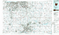
~ Cleveland South OH topo map, 1:100000 scale, 30 X 60 Minute, Historical, 1986, updated 1986
Cleveland South, Ohio, USGS topographic map dated 1986.
Includes geographic coordinates (latitude and longitude). This topographic map is suitable for hiking, camping, and exploring, or framing it as a wall map.
Printed on-demand using high resolution imagery, on heavy weight and acid free paper, or alternatively on a variety of synthetic materials.
Topos available on paper, Waterproof, Poly, or Tyvek. Usually shipping rolled, unless combined with other folded maps in one order.
- Product Number: USGS-5321480
- Free digital map download (high-resolution, GeoPDF): Cleveland South, Ohio (file size: 20 MB)
- Map Size: please refer to the dimensions of the GeoPDF map above
- Weight (paper map): ca. 55 grams
- Map Type: POD USGS Topographic Map
- Map Series: HTMC
- Map Verison: Historical
- Cell ID: 67311
- Scan ID: 226417
- Imprint Year: 1986
- Aerial Photo Year: 1982
- Edit Year: 1986
- Datum: NAD27
- Map Projection: Universal Transverse Mercator
- Planimetric: Yes
- Map published by United States Geological Survey
- Map Language: English
- Scanner Resolution: 600 dpi
- Map Cell Name: Cleveland South
- Grid size: 30 X 60 Minute
- Date on map: 1986
- Map Scale: 1:100000
- Geographical region: Ohio, United States
Neighboring Maps:
All neighboring USGS topo maps are available for sale online at a variety of scales.
Spatial coverage:
Topo map Cleveland South, Ohio, covers the geographical area associated the following places:
- Cobblestone Chase - Olmsted - Doolittles Corners - Industry - Southpark - Darrowville - Krumroy - Sherman (historical) - Plaza Trailer Court - Stoney Hill - Rosewood Estates - Orange - Glenwillow - Wayland - Hudson - North Springfield - Strongsville - Beachwood - Friendsville - Sagamore Hills - Nemes Trailer Park - Trailer Village - Poe - Montrose - Alexander - Greenleafs Corners (historical) - Briar Hill Corners - Westpark - Brimfield Station - Blackbrook Valley Estates - Sprotts Corners - Canterbury Estates - Novelty - Gloria Glens Park - Western Reserve Estates - River Styx - Seville - Johnsons Corners - Fair Acres - Edgewood Mobile Home Park - Countrywide Estates - Mantua Center - Hayes Corners - Walling Corners - Valley View - Clark Corners - Frank's Mobile Home Park - Clover Leaf Mobile Home Park - Queens Court - Meadow Lane - South Brooklyn - West Center - Clifton Park - Brunswick - Countryside Estates - Burton Lake - Yale - Broadview - Ohio Shores - Valley Hills - Wadsworth Trailer Park - Burton - Windfall - Little York - Ohio City - North Akron - Chippewa Lake - Randolph Acres Mobile Home Park - Chairmans Rowe - Suffield Station - Freedom Dam - Kent - Parma Heights - Bates Corners - Saint Joseph - Berkeley - East Center - North Linndale - Bay Village - Garden Valley - Eagle Cliff - Northampton Center - Dutch Alley - Hidden Cove Mobile Home Park - Gresham - Woodmere - Blake - Ghent - Thomastown - Richfield - Pleasant Valley - Balmoral - Botzum - J And M Trailer Court - Garfield Heights - Bear's Mobile Home Park - Solon - Hiram - Remsen Corners - Devonshire
- Map Area ID: AREA41.541-82-81
- Northwest corner Lat/Long code: USGSNW41.5-82
- Northeast corner Lat/Long code: USGSNE41.5-81
- Southwest corner Lat/Long code: USGSSW41-82
- Southeast corner Lat/Long code: USGSSE41-81
- Northern map edge Latitude: 41.5
- Southern map edge Latitude: 41
- Western map edge Longitude: -82
- Eastern map edge Longitude: -81

