
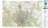
~ Cincinnati OH topo map, 1:100000 scale, 30 X 60 Minute, Historical, 1986, updated 1990
Cincinnati, Ohio, USGS topographic map dated 1986.
Includes geographic coordinates (latitude and longitude). This topographic map is suitable for hiking, camping, and exploring, or framing it as a wall map.
Printed on-demand using high resolution imagery, on heavy weight and acid free paper, or alternatively on a variety of synthetic materials.
Topos available on paper, Waterproof, Poly, or Tyvek. Usually shipping rolled, unless combined with other folded maps in one order.
- Product Number: USGS-5321474
- Free digital map download (high-resolution, GeoPDF): Cincinnati, Ohio (file size: 31 MB)
- Map Size: please refer to the dimensions of the GeoPDF map above
- Weight (paper map): ca. 55 grams
- Map Type: POD USGS Topographic Map
- Map Series: HTMC
- Map Verison: Historical
- Cell ID: 67296
- Scan ID: 226404
- Imprint Year: 1990
- Woodland Tint: Yes
- Visual Version Number: 2
- Aerial Photo Year: 1984
- Edit Year: 1986
- Datum: NAD27
- Map Projection: Universal Transverse Mercator
- Map published by United States Geological Survey
- Map Language: English
- Scanner Resolution: 600 dpi
- Map Cell Name: Cincinnati
- Grid size: 30 X 60 Minute
- Date on map: 1986
- Map Scale: 1:100000
- Geographical region: Ohio, United States
Neighboring Maps:
All neighboring USGS topo maps are available for sale online at a variety of scales.
Spatial coverage:
Topo map Cincinnati, Ohio, covers the geographical area associated the following places:
- Darrtown - Belmont - Macedonia - Brookwood - Perryville (historical) - Greenhills - Brookwood - The Estates At Wiedemann Mansion - Newkirk - Clertoma - Beech-Mar - Lincoln Heights - Wildbrook Acres - Sunburst Hills - Hardinsburg - Pringle Corners - Gieringer - Colerain Heights - Sixteen Mile Stand - Woodlawn - Clifton - Teakwood Acres - Bevis - Avoca Park - Plainville - Hunter - Deer Park - Sharonville - Over-The-Rhine - Allandale (historical) - Pleasant Hills - Norwood Heights - Camp Dennison - Silverton - Erlanger - Brookview - Fort Thomas - Withamsville - Fashion Heights - Belfast - Greendale - Losantville Triangle - Vermona - Perintown - San Je Village - Edgewood - Grand View - Stonewall Estates - Little Buck (historical) - Forestville - Evergreen Farm Estates - Compton Park - New Haven - Milford - LaFeuille Terrace - Avalon Heights - Spann (historical) - Johns Hill - Galaxy Acres - Golfway Acres - New Baltimore - Fordson Heights - Bonnell - South Fort Mitchell - Linn-Crest Acres - Huntcrest Acres - Cloud City (historical) - Sharptown - Skyline Acres - The Woods - Shandon - Green Acres - White Oak Meadows - Fairwind Acres - Wilmington - Indianview - Winters Lane (historical) - Ashdale - Simonsons (historical) - Prospect Hill - Dry Run - Mount Carmel - Wyoming - Ninemile - Faxon Hills - Senior - Spring Meadows - West Harrison - Pisgah - Riverview Heights - Dunlap - Sanfordtown - Fairfax - Beechwood (historical) - Lynnview - Tylersville - Cochran - Furmandale - Taylors Creek - Twightwee
- Map Area ID: AREA39.539-85-84
- Northwest corner Lat/Long code: USGSNW39.5-85
- Northeast corner Lat/Long code: USGSNE39.5-84
- Southwest corner Lat/Long code: USGSSW39-85
- Southeast corner Lat/Long code: USGSSE39-84
- Northern map edge Latitude: 39.5
- Southern map edge Latitude: 39
- Western map edge Longitude: -85
- Eastern map edge Longitude: -84


