
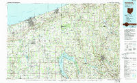
~ Ashtabula OH topo map, 1:100000 scale, 30 X 60 Minute, Historical, 1986, updated 1989
Ashtabula, Ohio, USGS topographic map dated 1986.
Includes geographic coordinates (latitude and longitude). This topographic map is suitable for hiking, camping, and exploring, or framing it as a wall map.
Printed on-demand using high resolution imagery, on heavy weight and acid free paper, or alternatively on a variety of synthetic materials.
Topos available on paper, Waterproof, Poly, or Tyvek. Usually shipping rolled, unless combined with other folded maps in one order.
- Product Number: USGS-5321460
- Free digital map download (high-resolution, GeoPDF): Ashtabula, Ohio (file size: 21 MB)
- Map Size: please refer to the dimensions of the GeoPDF map above
- Weight (paper map): ca. 55 grams
- Map Type: POD USGS Topographic Map
- Map Series: HTMC
- Map Verison: Historical
- Cell ID: 67068
- Scan ID: 226248
- Imprint Year: 1989
- Woodland Tint: Yes
- Photo Inspection Year: 1983
- Aerial Photo Year: 1982
- Edit Year: 1986
- Datum: NAD27
- Map Projection: Universal Transverse Mercator
- Map published by United States Geological Survey
- Map Language: English
- Scanner Resolution: 600 dpi
- Map Cell Name: Ashtabula
- Grid size: 30 X 60 Minute
- Date on map: 1986
- Map Scale: 1:100000
- Geographical region: Ohio, United States
Neighboring Maps:
All neighboring USGS topo maps are available for sale online at a variety of scales.
Spatial coverage:
Topo map Ashtabula, Ohio, covers the geographical area associated the following places:
- Gould - New Lyme Station - Paperville - Erieview - Rays Corners - Whispering Willows Mobile Home Park - Edinboro - Eagleville - Saegertown - North Kingsville - Conneaut Center - Meadville Junction - Mann - Saybrook - Hartsgrove - Mareddy Estates - Rome - Century Bay - Orwell - Sheffield Center - Austinburg - Keepville - Littles Corners - Asbury Park - Geneva - Rundell - North Richmond - Palmer - McLallen Corners - Tuttle Lake - Elks View - Harpersfield - Kidders Corner - Windsor - Southwood Colony - Platea - Reeds Corners - Edgewood - Turnersville - Cherry Hill - Custards - Mobile Acres - Hickernell - Turkey Foot Corner - Shipp - Springboro - Kantz Corners - Mosiertown - East Springfield - Denmark Center - Blacks Corner - Harbor - Sentinel - Cherry Valley - Highland Beach - Lavery - Theil's Mobile Home Park - Lakegrove Estates - Keyes Trailer Park - Porters Corners - Lundys Lane - Roaming Shores - Cork - East Orwell - Venango - Stony Point - Blooming Valley - Dorset - Lynces Junction - D F C Mobile Home Park - North Springfield - Gageville - Mechanicsville - Middleboro - Ivarea - Kingsville - Akerly - Amboy - Woodcock Grange - Normandy Village Mobile Home Park - East Ashtabula - Espyville - Dennys Corners - Mobile Grove Trailer Park - Delamater Corners - Watson Run - Pinney Corners - Colebrook - Plymouth Center - Shaws Landing - Jefferson - Cold Springs - Trumbull - Pageville - Kelloggsville - Richmond Center - Stoneville - Little Elk - Meadville - Plymouth
- Map Area ID: AREA4241.5-81-80
- Northwest corner Lat/Long code: USGSNW42-81
- Northeast corner Lat/Long code: USGSNE42-80
- Southwest corner Lat/Long code: USGSSW41.5-81
- Southeast corner Lat/Long code: USGSSE41.5-80
- Northern map edge Latitude: 42
- Southern map edge Latitude: 41.5
- Western map edge Longitude: -81
- Eastern map edge Longitude: -80


