
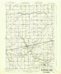
~ Swanton OH topo map, 1:62500 scale, 15 X 15 Minute, Historical, 1914, updated 1937
Swanton, Ohio, USGS topographic map dated 1914.
Includes geographic coordinates (latitude and longitude). This topographic map is suitable for hiking, camping, and exploring, or framing it as a wall map.
Printed on-demand using high resolution imagery, on heavy weight and acid free paper, or alternatively on a variety of synthetic materials.
Topos available on paper, Waterproof, Poly, or Tyvek. Usually shipping rolled, unless combined with other folded maps in one order.
- Product Number: USGS-5321336
- Free digital map download (high-resolution, GeoPDF): Swanton, Ohio (file size: 5 MB)
- Map Size: please refer to the dimensions of the GeoPDF map above
- Weight (paper map): ca. 55 grams
- Map Type: POD USGS Topographic Map
- Map Series: HTMC
- Map Verison: Historical
- Cell ID: 63188
- Scan ID: 226741
- Imprint Year: 1937
- Survey Year: 1911
- Datum: NAD
- Map Projection: Polyconic
- Map published by United States Geological Survey
- Map Language: English
- Scanner Resolution: 600 dpi
- Map Cell Name: Swanton
- Grid size: 15 X 15 Minute
- Date on map: 1914
- Map Scale: 1:62500
- Geographical region: Ohio, United States
Neighboring Maps:
All neighboring USGS topo maps are available for sale online at a variety of scales.
Spatial coverage:
Topo map Swanton, Ohio, covers the geographical area associated the following places:
- Swanton Meadows - Berkey - Crissey - Mulberry - Townline (historical) - Lytton - South Swanton - Siney (historical) - Linwood Court Mobile Home Park - Whiteville - Frankfort - Raab Corners - Brailey - Garden - Metamora - Chateau Estates - Arrowhead Lake - Whitehouse - Bowen (historical) - Assumption - Richfield Center - Mitchaw - Dutch Ridge - Midway - Treadway (historical) - Swanton - South Delta - Ai - Maplewood Park - Midway (historical) - Peaceful Valley - East Swanton - South Fairfield - Southland - Wilkins - Raker Corners - Sharples - Leslie (historical) - Swissaire Estates - Champion
- Map Area ID: AREA41.7541.5-84-83.75
- Northwest corner Lat/Long code: USGSNW41.75-84
- Northeast corner Lat/Long code: USGSNE41.75-83.75
- Southwest corner Lat/Long code: USGSSW41.5-84
- Southeast corner Lat/Long code: USGSSE41.5-83.75
- Northern map edge Latitude: 41.75
- Southern map edge Latitude: 41.5
- Western map edge Longitude: -84
- Eastern map edge Longitude: -83.75


