
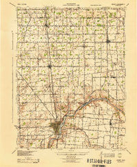
~ Sidney OH topo map, 1:62500 scale, 15 X 15 Minute, Historical, 1944
Sidney, Ohio, USGS topographic map dated 1944.
Includes geographic coordinates (latitude and longitude). This topographic map is suitable for hiking, camping, and exploring, or framing it as a wall map.
Printed on-demand using high resolution imagery, on heavy weight and acid free paper, or alternatively on a variety of synthetic materials.
Topos available on paper, Waterproof, Poly, or Tyvek. Usually shipping rolled, unless combined with other folded maps in one order.
- Product Number: USGS-5321300
- Free digital map download (high-resolution, GeoPDF): Sidney, Ohio (file size: 6 MB)
- Map Size: please refer to the dimensions of the GeoPDF map above
- Weight (paper map): ca. 55 grams
- Map Type: POD USGS Topographic Map
- Map Series: HTMC
- Map Verison: Historical
- Cell ID: 62534
- Scan ID: 227112
- Woodland Tint: Yes
- Aerial Photo Year: 1940
- Survey Year: 1911
- Datum: NAD
- Map Projection: Polyconic
- Map published by United States Army Corps of Engineers
- Map published by United States Department of War
- Map Language: English
- Scanner Resolution: 600 dpi
- Map Cell Name: Sidney
- Grid size: 15 X 15 Minute
- Date on map: 1944
- Map Scale: 1:62500
- Geographical region: Ohio, United States
Neighboring Maps:
All neighboring USGS topo maps are available for sale online at a variety of scales.
Spatial coverage:
Topo map Sidney, Ohio, covers the geographical area associated the following places:
- Christopher Northbrook Mobile Home Park - Pasco - Maplewood - Botkins - Newbern - Hardin - Port Jefferson - Jackson Center - Sidney - Pemberton - Rumley - Montra - Lakeside Village - Northumberland (historical) - Riverside Mobile Home Park - Buckeye Terrace - D and S Mobile Village - Anna - Swanders - Steinke Trailer Park - Northwood Mobile Home Park
- Map Area ID: AREA40.540.25-84.25-84
- Northwest corner Lat/Long code: USGSNW40.5-84.25
- Northeast corner Lat/Long code: USGSNE40.5-84
- Southwest corner Lat/Long code: USGSSW40.25-84.25
- Southeast corner Lat/Long code: USGSSE40.25-84
- Northern map edge Latitude: 40.5
- Southern map edge Latitude: 40.25
- Western map edge Longitude: -84.25
- Eastern map edge Longitude: -84


