
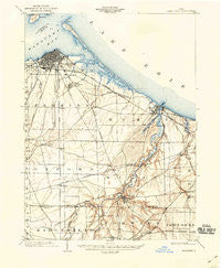
~ Sandusky OH topo map, 1:62500 scale, 15 X 15 Minute, Historical, 1904, updated 1941
Sandusky, Ohio, USGS topographic map dated 1904.
Includes geographic coordinates (latitude and longitude). This topographic map is suitable for hiking, camping, and exploring, or framing it as a wall map.
Printed on-demand using high resolution imagery, on heavy weight and acid free paper, or alternatively on a variety of synthetic materials.
Topos available on paper, Waterproof, Poly, or Tyvek. Usually shipping rolled, unless combined with other folded maps in one order.
- Product Number: USGS-5321268
- Free digital map download (high-resolution, GeoPDF): Sandusky, Ohio (file size: 6 MB)
- Map Size: please refer to the dimensions of the GeoPDF map above
- Weight (paper map): ca. 55 grams
- Map Type: POD USGS Topographic Map
- Map Series: HTMC
- Map Verison: Historical
- Cell ID: 62112
- Scan ID: 226917
- Imprint Year: 1941
- Visual Version Number: 2
- Survey Year: 1901
- Datum: NAD
- Map Projection: Polyconic
- Map published by United States Geological Survey
- Map Language: English
- Scanner Resolution: 600 dpi
- Map Cell Name: Sandusky
- Grid size: 15 X 15 Minute
- Date on map: 1904
- Map Scale: 1:62500
- Geographical region: Ohio, United States
Neighboring Maps:
All neighboring USGS topo maps are available for sale online at a variety of scales.
Spatial coverage:
Topo map Sandusky, Ohio, covers the geographical area associated the following places:
- Hoopers Mobile Home Park - Oberlin Beach - Anderson - Cedar Point - Rustic Hills Mobile Home Park - Greenfield Village Mobile Home Park - Fairview Lanes - Sandusky - Prout (historical) - Key Estates - Lions Park - North Milan - Bayshore Estates Mobile Home Park - Chaska Beach - East Norwalk - Bloomingville - Avery - Wilmer - Rye beach - Shinrock - Huron - Bogart - Ranch Wood - North Monroeville - North Palm Beach - Milan - Holiday Estates - Spears Corners - Grand Forest Beach - MacArthur Park - Kimball - Columbus Park - Berlinville - Lincolnshire - Southgate Acres
- Map Area ID: AREA41.541.25-82.75-82.5
- Northwest corner Lat/Long code: USGSNW41.5-82.75
- Northeast corner Lat/Long code: USGSNE41.5-82.5
- Southwest corner Lat/Long code: USGSSW41.25-82.75
- Southeast corner Lat/Long code: USGSSE41.25-82.5
- Northern map edge Latitude: 41.5
- Southern map edge Latitude: 41.25
- Western map edge Longitude: -82.75
- Eastern map edge Longitude: -82.5


