
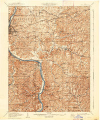
~ Philo OH topo map, 1:62500 scale, 15 X 15 Minute, Historical, 1910, updated 1938
Philo, Ohio, USGS topographic map dated 1910.
Includes geographic coordinates (latitude and longitude). This topographic map is suitable for hiking, camping, and exploring, or framing it as a wall map.
Printed on-demand using high resolution imagery, on heavy weight and acid free paper, or alternatively on a variety of synthetic materials.
Topos available on paper, Waterproof, Poly, or Tyvek. Usually shipping rolled, unless combined with other folded maps in one order.
- Product Number: USGS-5321218
- Free digital map download (high-resolution, GeoPDF): Philo, Ohio (file size: 11 MB)
- Map Size: please refer to the dimensions of the GeoPDF map above
- Weight (paper map): ca. 55 grams
- Map Type: POD USGS Topographic Map
- Map Series: HTMC
- Map Verison: Historical
- Cell ID: 60953
- Scan ID: 227515
- Imprint Year: 1938
- Survey Year: 1908
- Datum: NAD
- Map Projection: Polyconic
- Map published by United States Geological Survey
- Map Language: English
- Scanner Resolution: 600 dpi
- Map Cell Name: Philo
- Grid size: 15 X 15 Minute
- Date on map: 1910
- Map Scale: 1:62500
- Geographical region: Ohio, United States
Neighboring Maps:
All neighboring USGS topo maps are available for sale online at a variety of scales.
Spatial coverage:
Topo map Philo, Ohio, covers the geographical area associated the following places:
- Forest Hills - Sundale - High Hill - Duncan Falls - Hidden Mound - Museville - Southern Meadows - Oakland (historical) - Brush Creek - Pleasant Grove - Carlwick (historical) - Griffin - Rich Hill (historical) - Cedar Run - Spring Valley - Tile - Gaysport - Jackson (historical) - Eastlynd Acres - Smith Mill - Confederate Crossroads (historical) - White Eyes Town (historical) - Freeland - Mill Run - Blue Rock - Homestead Hills - Chandlersville - McDonald - Ruraldale - Buckeye - Smith (historical) - Seawright (historical) - Norwich - Georgetown - Philo - Wortley - Lawton (historical) - Pierce (historical) - Bridgeville - Stone - Sealover (historical) - Willow Lakes - Brookover (historical) - Sonora - Riverview - Cannelville - Durant - Frazier - Stovertown - Merriam
- Map Area ID: AREA4039.75-82-81.75
- Northwest corner Lat/Long code: USGSNW40-82
- Northeast corner Lat/Long code: USGSNE40-81.75
- Southwest corner Lat/Long code: USGSSW39.75-82
- Southeast corner Lat/Long code: USGSSE39.75-81.75
- Northern map edge Latitude: 40
- Southern map edge Latitude: 39.75
- Western map edge Longitude: -82
- Eastern map edge Longitude: -81.75


