
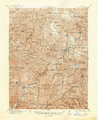
~ Oak Hill OH topo map, 1:62500 scale, 15 X 15 Minute, Historical, 1912, updated 1948
Oak Hill, Ohio, USGS topographic map dated 1912.
Includes geographic coordinates (latitude and longitude). This topographic map is suitable for hiking, camping, and exploring, or framing it as a wall map.
Printed on-demand using high resolution imagery, on heavy weight and acid free paper, or alternatively on a variety of synthetic materials.
Topos available on paper, Waterproof, Poly, or Tyvek. Usually shipping rolled, unless combined with other folded maps in one order.
- Product Number: USGS-5321176
- Free digital map download (high-resolution, GeoPDF): Oak Hill, Ohio (file size: 11 MB)
- Map Size: please refer to the dimensions of the GeoPDF map above
- Weight (paper map): ca. 55 grams
- Map Type: POD USGS Topographic Map
- Map Series: HTMC
- Map Verison: Historical
- Cell ID: 60443
- Scan ID: 227364
- Imprint Year: 1948
- Survey Year: 1910
- Datum: NAD
- Map Projection: Polyconic
- Map published by United States Geological Survey
- Map Language: English
- Scanner Resolution: 600 dpi
- Map Cell Name: Oak Hill
- Grid size: 15 X 15 Minute
- Date on map: 1912
- Map Scale: 1:62500
- Geographical region: Ohio, United States
Neighboring Maps:
All neighboring USGS topo maps are available for sale online at a variety of scales.
Spatial coverage:
Topo map Oak Hill, Ohio, covers the geographical area associated the following places:
- Madland (historical) - Blackfork - Firebrick - McKitterick (historical) - Camba - Limestone (historical) - Olive Furnace - Winchester - Peniel - Horeb - Oak Hill - Kitchen - Four Mile - Petersburg - Rempel - Bloom Junction - Pyro - South Webster - Eifort - Keystone - Clay - Monroe - Hales Creek - Hitchcock - Gallia - Grahamsville - Banner - McCoy - Hoadley - Mabee Corner - Blackfork Junction - Rocky Hill
- Map Area ID: AREA3938.75-82.75-82.5
- Northwest corner Lat/Long code: USGSNW39-82.75
- Northeast corner Lat/Long code: USGSNE39-82.5
- Southwest corner Lat/Long code: USGSSW38.75-82.75
- Southeast corner Lat/Long code: USGSSE38.75-82.5
- Northern map edge Latitude: 39
- Southern map edge Latitude: 38.75
- Western map edge Longitude: -82.75
- Eastern map edge Longitude: -82.5


