
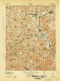
~ Navarre OH topo map, 1:62500 scale, 15 X 15 Minute, Historical, 1944
Navarre, Ohio, USGS topographic map dated 1944.
Includes geographic coordinates (latitude and longitude). This topographic map is suitable for hiking, camping, and exploring, or framing it as a wall map.
Printed on-demand using high resolution imagery, on heavy weight and acid free paper, or alternatively on a variety of synthetic materials.
Topos available on paper, Waterproof, Poly, or Tyvek. Usually shipping rolled, unless combined with other folded maps in one order.
- Product Number: USGS-5321140
- Free digital map download (high-resolution, GeoPDF): Navarre, Ohio (file size: 9 MB)
- Map Size: please refer to the dimensions of the GeoPDF map above
- Weight (paper map): ca. 55 grams
- Map Type: POD USGS Topographic Map
- Map Series: HTMC
- Map Verison: Historical
- Cell ID: 58292
- Scan ID: 227584
- Woodland Tint: Yes
- Aerial Photo Year: 1942
- Survey Year: 1911
- Datum: NAD
- Map Projection: Polyconic
- Map published by United States Army Corps of Engineers
- Map published by United States Department of War
- Map Language: English
- Scanner Resolution: 600 dpi
- Map Cell Name: Navarre
- Grid size: 15 X 15 Minute
- Date on map: 1944
- Map Scale: 1:62500
- Geographical region: Ohio, United States
Neighboring Maps:
All neighboring USGS topo maps are available for sale online at a variety of scales.
Spatial coverage:
Topo map Navarre, Ohio, covers the geographical area associated the following places:
- Deardoffs Mills (historical) - Walnut Creek - Beartown - Canton Road - Sugarcreek - Cozy Acres - Harmon - Wilmot - Columbia - Navarre - Winfield - Hillview Mobile Court - Pigeon Run - Trail - Strasburg - Barrs Mills - Smoketown - Plainsburg (historical) - Navarre Village - Camp Creek - Elton - North Brewster - Kidron - Mount Eaton - Shanesville - Brewster - Winesburg - Mapleview Mobile Home Manor - Rockville - West Lebanon - Dundee - Crossroads - Loudon - Brewster Estates Mobile Home Park - Justus - Tarrymore - Winklepleck Grove - Beach City - Unionville - Park Heights - Limpytown
- Map Area ID: AREA40.7540.5-81.75-81.5
- Northwest corner Lat/Long code: USGSNW40.75-81.75
- Northeast corner Lat/Long code: USGSNE40.75-81.5
- Southwest corner Lat/Long code: USGSSW40.5-81.75
- Southeast corner Lat/Long code: USGSSE40.5-81.5
- Northern map edge Latitude: 40.75
- Southern map edge Latitude: 40.5
- Western map edge Longitude: -81.75
- Eastern map edge Longitude: -81.5


