
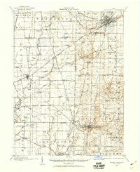
~ Mount Gilead OH topo map, 1:62500 scale, 15 X 15 Minute, Historical, 1913, updated 1960
Mount Gilead, Ohio, USGS topographic map dated 1913.
Includes geographic coordinates (latitude and longitude). This topographic map is suitable for hiking, camping, and exploring, or framing it as a wall map.
Printed on-demand using high resolution imagery, on heavy weight and acid free paper, or alternatively on a variety of synthetic materials.
Topos available on paper, Waterproof, Poly, or Tyvek. Usually shipping rolled, unless combined with other folded maps in one order.
- Product Number: USGS-5321124
- Free digital map download (high-resolution, GeoPDF): Mount Gilead, Ohio (file size: 7 MB)
- Map Size: please refer to the dimensions of the GeoPDF map above
- Weight (paper map): ca. 55 grams
- Map Type: POD USGS Topographic Map
- Map Series: HTMC
- Map Verison: Historical
- Cell ID: 57981
- Scan ID: 227547
- Imprint Year: 1960
- Survey Year: 1913
- Datum: NAD27
- Map Projection: Polyconic
- Map published by United States Geological Survey
- Map Language: English
- Scanner Resolution: 600 dpi
- Map Cell Name: Mount Gilead
- Grid size: 15 X 15 Minute
- Date on map: 1913
- Map Scale: 1:62500
- Geographical region: Ohio, United States
Neighboring Maps:
All neighboring USGS topo maps are available for sale online at a variety of scales.
Spatial coverage:
Topo map Mount Gilead, Ohio, covers the geographical area associated the following places:
- Weir Mobile Home Park - New Winchester - Climax - Galion - Stringtown (historical) - West Point - Caledonia - Country View Mobile Home Park - Beech (historical) - Rainbow Mobile Home Park - Claridon - Northgate Mobile Home Park - Cardington - Surprise (historical) - Mount Gilead - Saint James - Wood Valley - Denmark - Spring Valley Court - Westview Mobile Home Park - Martel - Mohawk Mobile Estates - Olentangy Estates - Edison - Whetstone Trailer Park - Russell - Iberia
- Map Area ID: AREA40.7540.5-83-82.75
- Northwest corner Lat/Long code: USGSNW40.75-83
- Northeast corner Lat/Long code: USGSNE40.75-82.75
- Southwest corner Lat/Long code: USGSSW40.5-83
- Southeast corner Lat/Long code: USGSSE40.5-82.75
- Northern map edge Latitude: 40.75
- Southern map edge Latitude: 40.5
- Western map edge Longitude: -83
- Eastern map edge Longitude: -82.75


