
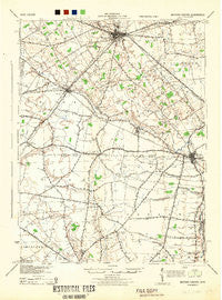
~ Milford Center OH topo map, 1:62500 scale, 15 X 15 Minute, Historical, 1944
Milford Center, Ohio, USGS topographic map dated 1944.
Includes geographic coordinates (latitude and longitude). This topographic map is suitable for hiking, camping, and exploring, or framing it as a wall map.
Printed on-demand using high resolution imagery, on heavy weight and acid free paper, or alternatively on a variety of synthetic materials.
Topos available on paper, Waterproof, Poly, or Tyvek. Usually shipping rolled, unless combined with other folded maps in one order.
- Product Number: USGS-5321108
- Free digital map download (high-resolution, GeoPDF): Milford Center, Ohio (file size: 5 MB)
- Map Size: please refer to the dimensions of the GeoPDF map above
- Weight (paper map): ca. 55 grams
- Map Type: POD USGS Topographic Map
- Map Series: HTMC
- Map Verison: Historical
- Cell ID: 57644
- Scan ID: 227886
- Woodland Tint: Yes
- Aerial Photo Year: 1941
- Survey Year: 1914
- Datum: NAD
- Map Projection: Polyconic
- Map published by United States Army Corps of Engineers
- Map published by United States Department of War
- Map Language: English
- Scanner Resolution: 600 dpi
- Map Cell Name: Milford Center
- Grid size: 15 X 15 Minute
- Date on map: 1944
- Map Scale: 1:62500
- Geographical region: Ohio, United States
Neighboring Maps:
All neighboring USGS topo maps are available for sale online at a variety of scales.
Spatial coverage:
Topo map Milford Center, Ohio, covers the geographical area associated the following places:
- Rosedale - Plumwood - Mill Creek Estates - New Dover - Hunters Run - Irwin - Milford Estates - Marysville - Marysville Estates - Countryside Mobile Home Park - Carriage Acres - Syphrit Mobile Home Park - Hillcrest Mobile Home Park - Bridgeport - Milford Center - Millcreek Meadows - Amity - Buxton Meadows - Allen Center - Chuckery - Canaan Community Mobile Home Park - Resaca - Arnold - Adena Pointe - Plain City - Hickory Run - Troyer Mobile Home Park - Pleasant Ridge - Unionville Center - Darby Meadows - Dipple - Greenwood Colony - Green Pastures
- Map Area ID: AREA40.2540-83.5-83.25
- Northwest corner Lat/Long code: USGSNW40.25-83.5
- Northeast corner Lat/Long code: USGSNE40.25-83.25
- Southwest corner Lat/Long code: USGSSW40-83.5
- Southeast corner Lat/Long code: USGSSE40-83.25
- Northern map edge Latitude: 40.25
- Southern map edge Latitude: 40
- Western map edge Longitude: -83.5
- Eastern map edge Longitude: -83.25


