
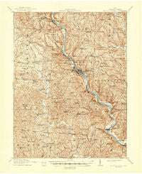
~ Mc Connelsville OH topo map, 1:62500 scale, 15 X 15 Minute, Historical, 1910, updated 1948
Mc Connelsville, Ohio, USGS topographic map dated 1910.
Includes geographic coordinates (latitude and longitude). This topographic map is suitable for hiking, camping, and exploring, or framing it as a wall map.
Printed on-demand using high resolution imagery, on heavy weight and acid free paper, or alternatively on a variety of synthetic materials.
Topos available on paper, Waterproof, Poly, or Tyvek. Usually shipping rolled, unless combined with other folded maps in one order.
- Product Number: USGS-5321092
- Free digital map download (high-resolution, GeoPDF): Mc Connelsville, Ohio (file size: 11 MB)
- Map Size: please refer to the dimensions of the GeoPDF map above
- Weight (paper map): ca. 55 grams
- Map Type: POD USGS Topographic Map
- Map Series: HTMC
- Map Verison: Historical
- Cell ID: 57340
- Scan ID: 227799
- Imprint Year: 1948
- Survey Year: 1908
- Datum: Unstated
- Map Projection: Polyconic
- Map published by United States Geological Survey
- Map Language: English
- Scanner Resolution: 600 dpi
- Map Cell Name: McConnelsville
- Grid size: 15 X 15 Minute
- Date on map: 1910
- Map Scale: 1:62500
- Geographical region: Ohio, United States
Neighboring Maps:
All neighboring USGS topo maps are available for sale online at a variety of scales.
Spatial coverage:
Topo map Mc Connelsville, Ohio, covers the geographical area associated the following places:
- Rosseau - Rokeby Lock - Morganville - Meigs - Joetown - Gladdens Trailer Court - Chaneyville (historical) - McConnelsville - Chadwick (historical) - Eagleport - Ringgold - Pennsville - Stockport - Shilling (historical) - Cloud (historical) - Neelysville - Airington (historical) - Lovell - Halls Valley (historical) - Elliott Crossroads - Mountville - Hooksburg - Todds - Rowland (historical) - Westland - Morgan Meadows Mobile Home Park - Malta - Triadelphia
- Map Area ID: AREA39.7539.5-82-81.75
- Northwest corner Lat/Long code: USGSNW39.75-82
- Northeast corner Lat/Long code: USGSNE39.75-81.75
- Southwest corner Lat/Long code: USGSSW39.5-82
- Southeast corner Lat/Long code: USGSSE39.5-81.75
- Northern map edge Latitude: 39.75
- Southern map edge Latitude: 39.5
- Western map edge Longitude: -82
- Eastern map edge Longitude: -81.75


