
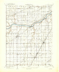
~ Mc Clure OH topo map, 1:62500 scale, 15 X 15 Minute, Historical, 1909, updated 1936
Mc Clure, Ohio, USGS topographic map dated 1909.
Includes geographic coordinates (latitude and longitude). This topographic map is suitable for hiking, camping, and exploring, or framing it as a wall map.
Printed on-demand using high resolution imagery, on heavy weight and acid free paper, or alternatively on a variety of synthetic materials.
Topos available on paper, Waterproof, Poly, or Tyvek. Usually shipping rolled, unless combined with other folded maps in one order.
- Product Number: USGS-5321088
- Free digital map download (high-resolution, GeoPDF): Mc Clure, Ohio (file size: 5 MB)
- Map Size: please refer to the dimensions of the GeoPDF map above
- Weight (paper map): ca. 55 grams
- Map Type: POD USGS Topographic Map
- Map Series: HTMC
- Map Verison: Historical
- Cell ID: 57337
- Scan ID: 227790
- Imprint Year: 1936
- Visual Version Number: 1
- Survey Year: 1907
- Datum: Unstated
- Map Projection: Polyconic
- Map published by United States Geological Survey
- Map Language: English
- Scanner Resolution: 600 dpi
- Map Cell Name: McClure
- Grid size: 15 X 15 Minute
- Date on map: 1909
- Map Scale: 1:62500
- Geographical region: Ohio, United States
Neighboring Maps:
All neighboring USGS topo maps are available for sale online at a variety of scales.
Spatial coverage:
Topo map Mc Clure, Ohio, covers the geographical area associated the following places:
- Westhope - Bailey - Otsego - Weston - Lawndale Mobile Home Plaza - Riverview Trailer Court - Custar - Grand Rapids - Tondagamies Village (historical) - Haney (historical) - Willow Haven Trailer Court - Texas - Neapolis - Weston Trailer Court - McClure - Providence - Williamsburg-On-The-River - Milton Center - Neowash (historical) - Colton - Grelton
- Map Area ID: AREA41.541.25-84-83.75
- Northwest corner Lat/Long code: USGSNW41.5-84
- Northeast corner Lat/Long code: USGSNE41.5-83.75
- Southwest corner Lat/Long code: USGSSW41.25-84
- Southeast corner Lat/Long code: USGSSE41.25-83.75
- Northern map edge Latitude: 41.5
- Southern map edge Latitude: 41.25
- Western map edge Longitude: -84
- Eastern map edge Longitude: -83.75


