
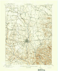
~ Greenfield OH topo map, 1:62500 scale, 15 X 15 Minute, Historical, 1917, updated 1937
Greenfield, Ohio, USGS topographic map dated 1917.
Includes geographic coordinates (latitude and longitude). This topographic map is suitable for hiking, camping, and exploring, or framing it as a wall map.
Printed on-demand using high resolution imagery, on heavy weight and acid free paper, or alternatively on a variety of synthetic materials.
Topos available on paper, Waterproof, Poly, or Tyvek. Usually shipping rolled, unless combined with other folded maps in one order.
- Product Number: USGS-5320952
- Free digital map download (high-resolution, GeoPDF): Greenfield, Ohio (file size: 7 MB)
- Map Size: please refer to the dimensions of the GeoPDF map above
- Weight (paper map): ca. 55 grams
- Map Type: POD USGS Topographic Map
- Map Series: HTMC
- Map Verison: Historical
- Cell ID: 54827
- Scan ID: 225250
- Imprint Year: 1937
- Visual Version Number: 2
- Survey Year: 1914
- Datum: NAD
- Map Projection: Polyconic
- Map published by United States Geological Survey
- Map Language: English
- Scanner Resolution: 600 dpi
- Map Cell Name: Greenfield
- Grid size: 15 X 15 Minute
- Date on map: 1917
- Map Scale: 1:62500
- Geographical region: Ohio, United States
Neighboring Maps:
All neighboring USGS topo maps are available for sale online at a variety of scales.
Spatial coverage:
Topo map Greenfield, Ohio, covers the geographical area associated the following places:
- Buena Vista - Staunton - New Petersburg - Fairview - New Martinsburg - McLean - Thrifton - Fruitdale - Kimballs Mobile Home Park - Boyds - Thornton (historical) - Plano - Heglers (historical) - Harper - New Salem (historical) - Ghormley (historical) - South Salem - Lyndon - Greenfield - Humboldt - Good Hope - East Monroe - Rock Mills
- Map Area ID: AREA39.539.25-83.5-83.25
- Northwest corner Lat/Long code: USGSNW39.5-83.5
- Northeast corner Lat/Long code: USGSNE39.5-83.25
- Southwest corner Lat/Long code: USGSSW39.25-83.5
- Southeast corner Lat/Long code: USGSSE39.25-83.25
- Northern map edge Latitude: 39.5
- Southern map edge Latitude: 39.25
- Western map edge Longitude: -83.5
- Eastern map edge Longitude: -83.25


