
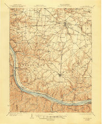
~ Felicity OH topo map, 1:62500 scale, 15 X 15 Minute, Historical, 1931, updated 1947
Felicity, Ohio, USGS topographic map dated 1931.
Includes geographic coordinates (latitude and longitude). This topographic map is suitable for hiking, camping, and exploring, or framing it as a wall map.
Printed on-demand using high resolution imagery, on heavy weight and acid free paper, or alternatively on a variety of synthetic materials.
Topos available on paper, Waterproof, Poly, or Tyvek. Usually shipping rolled, unless combined with other folded maps in one order.
- Product Number: USGS-5320898
- Free digital map download (high-resolution, GeoPDF): Felicity, Ohio (file size: 9 MB)
- Map Size: please refer to the dimensions of the GeoPDF map above
- Weight (paper map): ca. 55 grams
- Map Type: POD USGS Topographic Map
- Map Series: HTMC
- Map Verison: Historical
- Cell ID: 54109
- Scan ID: 225037
- Imprint Year: 1947
- Survey Year: 1928
- Datum: NAD
- Map Projection: Polyconic
- Map published by United States Geological Survey
- Map Language: English
- Scanner Resolution: 600 dpi
- Map Cell Name: Felicity
- Grid size: 15 X 15 Minute
- Date on map: 1931
- Map Scale: 1:62500
- Geographical region: Ohio, United States
Neighboring Maps:
All neighboring USGS topo maps are available for sale online at a variety of scales.
Spatial coverage:
Topo map Felicity, Ohio, covers the geographical area associated the following places:
- Mount Olive - Mount Pisgah - Laurel - Pinhook - Utopia - Saltair - South Bantam - Stringtown - Fair Oak (historical) - Point Pleasant - Moscow - Point Isabel - Wiggonsville - Bantam - Willow Grove - Rural - Felicity - Lindale - Rock Springs - Bradford - Clover - Johnsville - Maple - Mentor - Cedron - Hulington - Yankeetown - Nicholsville - Neville - Bethel - Augusta - Ivor - Carntown - Chilo - Foster - Wellsburg - Locust Ridge
- Map Area ID: AREA3938.75-84.25-84
- Northwest corner Lat/Long code: USGSNW39-84.25
- Northeast corner Lat/Long code: USGSNE39-84
- Southwest corner Lat/Long code: USGSSW38.75-84.25
- Southeast corner Lat/Long code: USGSSE38.75-84
- Northern map edge Latitude: 39
- Southern map edge Latitude: 38.75
- Western map edge Longitude: -84.25
- Eastern map edge Longitude: -84


