
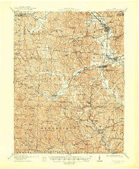
~ Cumberland OH topo map, 1:62500 scale, 15 X 15 Minute, Historical, 1911, updated 1948
Cumberland, Ohio, USGS topographic map dated 1911.
Includes geographic coordinates (latitude and longitude). This topographic map is suitable for hiking, camping, and exploring, or framing it as a wall map.
Printed on-demand using high resolution imagery, on heavy weight and acid free paper, or alternatively on a variety of synthetic materials.
Topos available on paper, Waterproof, Poly, or Tyvek. Usually shipping rolled, unless combined with other folded maps in one order.
- Product Number: USGS-5320824
- Free digital map download (high-resolution, GeoPDF): Cumberland, Ohio (file size: 10 MB)
- Map Size: please refer to the dimensions of the GeoPDF map above
- Weight (paper map): ca. 55 grams
- Map Type: POD USGS Topographic Map
- Map Series: HTMC
- Map Verison: Historical
- Cell ID: 53138
- Scan ID: 224600
- Imprint Year: 1948
- Survey Year: 1909
- Datum: NAD
- Map Projection: Polyconic
- Map published by United States Geological Survey
- Map Language: English
- Scanner Resolution: 600 dpi
- Map Cell Name: Cumberland
- Grid size: 15 X 15 Minute
- Date on map: 1911
- Map Scale: 1:62500
- Geographical region: Ohio, United States
Neighboring Maps:
All neighboring USGS topo maps are available for sale online at a variety of scales.
Spatial coverage:
Topo map Cumberland, Ohio, covers the geographical area associated the following places:
- Claysville - Cumberland - Derwent - Coal Ridge - Renrock - Coal Hill - Slaters - Country Court Mobile Home Park - Pleasant City - Florence - Hiramsburg - Mount Zion - Marysville - Bluebell - Colonial Heights - Morgan Manor - Hoskinsville - Scott (historical) - Jackson Special - Spratt - Hunter (historical) - Ava - Fairview - Saint Clair (historical) - Buffalo - Lucasburg - Kipling - Buckeyeville - New Concord - Oakwood - Young Hickory - Ideal - Rochester - Spring Valley - Glenwood - Opperman - Greenwood Mobile Home Park - Helena - Rix Mills - Zeno - Robins - Byesville - Belle Valley
- Map Area ID: AREA4039.75-81.75-81.5
- Northwest corner Lat/Long code: USGSNW40-81.75
- Northeast corner Lat/Long code: USGSNE40-81.5
- Southwest corner Lat/Long code: USGSSW39.75-81.75
- Southeast corner Lat/Long code: USGSSE39.75-81.5
- Northern map edge Latitude: 40
- Southern map edge Latitude: 39.75
- Western map edge Longitude: -81.75
- Eastern map edge Longitude: -81.5


