
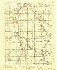
~ Continental OH topo map, 1:62500 scale, 15 X 15 Minute, Historical, 1909, updated 1943
Continental, Ohio, USGS topographic map dated 1909.
Includes geographic coordinates (latitude and longitude). This topographic map is suitable for hiking, camping, and exploring, or framing it as a wall map.
Printed on-demand using high resolution imagery, on heavy weight and acid free paper, or alternatively on a variety of synthetic materials.
Topos available on paper, Waterproof, Poly, or Tyvek. Usually shipping rolled, unless combined with other folded maps in one order.
- Product Number: USGS-5320802
- Free digital map download (high-resolution, GeoPDF): Continental, Ohio (file size: 5 MB)
- Map Size: please refer to the dimensions of the GeoPDF map above
- Weight (paper map): ca. 55 grams
- Map Type: POD USGS Topographic Map
- Map Series: HTMC
- Map Verison: Historical
- Cell ID: 52888
- Scan ID: 224547
- Imprint Year: 1943
- Survey Year: 1908
- Datum: Unstated
- Map Projection: Polyconic
- Map published by United States Geological Survey
- Map Language: English
- Scanner Resolution: 600 dpi
- Map Cell Name: Continental
- Grid size: 15 X 15 Minute
- Date on map: 1909
- Map Scale: 1:62500
- Geographical region: Ohio, United States
Neighboring Maps:
All neighboring USGS topo maps are available for sale online at a variety of scales.
Spatial coverage:
Topo map Continental, Ohio, covers the geographical area associated the following places:
- Saint Andrews (historical) - Murat (historical) - Roselms - Huntstown (historical) - Melrose - Etties-Burg (historical) - Cloverdale - Fort Brown - Hartsburg - Newburgh (historical) - Charloe - Mobile Manor - Ball Subdivision - Continental - Southerton - Franconia (historical) - Junction - Plumbs Cross Roads (historical) - Oakwood - Arthur - Rice - Dupont - East Mandale - Ayersville - Renollet (historical) - Mandale - Canalport - Timberville (historical) - Countryside Estates - Cascade - Goodwin (historical) - Grover Hill - Molasses Gap
- Map Area ID: AREA41.2541-84.5-84.25
- Northwest corner Lat/Long code: USGSNW41.25-84.5
- Northeast corner Lat/Long code: USGSNE41.25-84.25
- Southwest corner Lat/Long code: USGSSW41-84.5
- Southeast corner Lat/Long code: USGSSE41-84.25
- Northern map edge Latitude: 41.25
- Southern map edge Latitude: 41
- Western map edge Longitude: -84.5
- Eastern map edge Longitude: -84.25


