
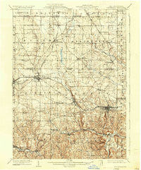
~ Columbiana OH topo map, 1:62500 scale, 15 X 15 Minute, Historical, 1909, updated 1937
Columbiana, Ohio, USGS topographic map dated 1909.
Includes geographic coordinates (latitude and longitude). This topographic map is suitable for hiking, camping, and exploring, or framing it as a wall map.
Printed on-demand using high resolution imagery, on heavy weight and acid free paper, or alternatively on a variety of synthetic materials.
Topos available on paper, Waterproof, Poly, or Tyvek. Usually shipping rolled, unless combined with other folded maps in one order.
- Product Number: USGS-5320786
- Free digital map download (high-resolution, GeoPDF): Columbiana, Ohio (file size: 8 MB)
- Map Size: please refer to the dimensions of the GeoPDF map above
- Weight (paper map): ca. 55 grams
- Map Type: POD USGS Topographic Map
- Map Series: HTMC
- Map Verison: Historical
- Cell ID: 52834
- Scan ID: 224503
- Imprint Year: 1937
- Survey Year: 1907
- Datum: NAD
- Map Projection: Polyconic
- Map published by United States Geological Survey
- Map Language: English
- Scanner Resolution: 600 dpi
- Map Cell Name: Columbiana
- Grid size: 15 X 15 Minute
- Date on map: 1909
- Map Scale: 1:62500
- Geographical region: Ohio, United States
Neighboring Maps:
All neighboring USGS topo maps are available for sale online at a variety of scales.
Spatial coverage:
Topo map Columbiana, Ohio, covers the geographical area associated the following places:
- Elkton - Southern Terrace Park - Beechwood Mobile Estates - Signal - New Middletown - Maplecroft Mobile Home Park - Middleton - Smith Corners - Newhouse (historical) - Subrosa (historical) - Jimtown - Petersburg - Boyer - Pleasant Valley Mobile Home Park - Morgantown - J And H Mobile Home Park - Union Ridge - East Carmel - North Lima - Deer Meadow Mobile Home Park - Porters Corners - Unity - Snyder (historical) - State Line (historical) - Unionville - Woodworth - Columbiana - Meadowood - East Fairfield - Paradise - Island - Germantown - Five Points - Shadybrook Mobile Home Park - New Buffalo - Rogers - Ginger Hill - Clearwood Court - New Waterford - Mill Rock - Willow Crest - Negley - Lynn Mobile Manor - Wheat Hill Estates - East Lewistown - Saratoga (historical) - Eureka - Achor - McClurg - East Palestine - New Springfield - Sunshine Mobile Home Park
- Map Area ID: AREA4140.75-80.75-80.5
- Northwest corner Lat/Long code: USGSNW41-80.75
- Northeast corner Lat/Long code: USGSNE41-80.5
- Southwest corner Lat/Long code: USGSSW40.75-80.75
- Southeast corner Lat/Long code: USGSSE40.75-80.5
- Northern map edge Latitude: 41
- Southern map edge Latitude: 40.75
- Western map edge Longitude: -80.75
- Eastern map edge Longitude: -80.5


