
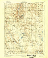
~ Chagrin Falls OH topo map, 1:62500 scale, 15 X 15 Minute, Historical, 1908, updated 1939
Chagrin Falls, Ohio, USGS topographic map dated 1908.
Includes geographic coordinates (latitude and longitude). This topographic map is suitable for hiking, camping, and exploring, or framing it as a wall map.
Printed on-demand using high resolution imagery, on heavy weight and acid free paper, or alternatively on a variety of synthetic materials.
Topos available on paper, Waterproof, Poly, or Tyvek. Usually shipping rolled, unless combined with other folded maps in one order.
- Product Number: USGS-5320750
- Free digital map download (high-resolution, GeoPDF): Chagrin Falls, Ohio (file size: 7 MB)
- Map Size: please refer to the dimensions of the GeoPDF map above
- Weight (paper map): ca. 55 grams
- Map Type: POD USGS Topographic Map
- Map Series: HTMC
- Map Verison: Historical
- Cell ID: 52348
- Scan ID: 224368
- Imprint Year: 1939
- Survey Year: 1906
- Datum: Unstated
- Map Projection: Polyconic
- Map published by United States Geological Survey
- Map Language: English
- Scanner Resolution: 600 dpi
- Map Cell Name: Chagrin Falls
- Grid size: 15 X 15 Minute
- Date on map: 1908
- Map Scale: 1:62500
- Geographical region: Ohio, United States
Neighboring Maps:
All neighboring USGS topo maps are available for sale online at a variety of scales.
Spatial coverage:
Topo map Chagrin Falls, Ohio, covers the geographical area associated the following places:
- Beudale (historical) - Chagrin Falls - South Russell - Moreland Hills - Bainbridge - Falls Junction - Solon - Beartown - Geauga Lake - Highland Springs - Moran - Silo - McFarlands Corners - Novelty - Twinsburg - Lake Lucerne - Western Reserve Estates - Aurora - North Solon - Glenwillow Mobile Home Park - Orange Center - Cowans (historical) - Applecreek Village - Spring Valley - Reminderville - Woodmere - Pepper Pike - Bosworth (historical) - Fullertown - Russell Center - Evergreen Manor - Hunting Valley - Twinsburg Heights - Yates Corners - Briar Hill Corners - Taborville - Julia (historical) - Orange - Glenwillow - Chagrin Falls Park - Bentleyville - Camelot Village - Beacon Hill
- Map Area ID: AREA41.541.25-81.5-81.25
- Northwest corner Lat/Long code: USGSNW41.5-81.5
- Northeast corner Lat/Long code: USGSNE41.5-81.25
- Southwest corner Lat/Long code: USGSSW41.25-81.5
- Southeast corner Lat/Long code: USGSSE41.25-81.25
- Northern map edge Latitude: 41.5
- Southern map edge Latitude: 41.25
- Western map edge Longitude: -81.5
- Eastern map edge Longitude: -81.25


