
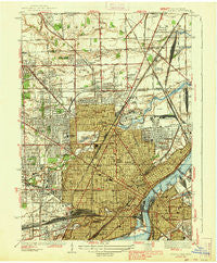
~ Toledo OH topo map, 1:31680 scale, 7.5 X 7.5 Minute, Historical, 1938
Toledo, Ohio, USGS topographic map dated 1938.
Includes geographic coordinates (latitude and longitude). This topographic map is suitable for hiking, camping, and exploring, or framing it as a wall map.
Printed on-demand using high resolution imagery, on heavy weight and acid free paper, or alternatively on a variety of synthetic materials.
Topos available on paper, Waterproof, Poly, or Tyvek. Usually shipping rolled, unless combined with other folded maps in one order.
- Product Number: USGS-5320584
- Free digital map download (high-resolution, GeoPDF): Toledo, Ohio (file size: 8 MB)
- Map Size: please refer to the dimensions of the GeoPDF map above
- Weight (paper map): ca. 55 grams
- Map Type: POD USGS Topographic Map
- Map Series: HTMC
- Map Verison: Historical
- Cell ID: 45327
- Scan ID: 226799
- Woodland Tint: Yes
- Visual Version Number: 2
- Survey Year: 1934
- Datum: NAD27
- Map Projection: Polyconic
- Map published by United States Geological Survey
- Map Language: English
- Scanner Resolution: 600 dpi
- Map Cell Name: Toledo
- Grid size: 7.5 X 7.5 Minute
- Date on map: 1938
- Map Scale: 1:31680
- Geographical region: Ohio, United States
Neighboring Maps:
All neighboring USGS topo maps are available for sale online at a variety of scales.
Spatial coverage:
Topo map Toledo, Ohio, covers the geographical area associated the following places:
- Wernerts Corners - East Toledo - Hallett - Oakwood Mobile Home Community - West Toledo - Toledo - Air Line Junction - Fitch - Northgate - Liberty Corners - Alexis Addition - Freemans Gardens - Auburndale - Hopewell Heights - Vulcan - Trilby - Mellwood - Mayfair Park - Boulevard - Ferndale - Inverness Mobile Home Community - Northtown Meadows Mobile Home Park - Nasby - Erie Mobile Home Village
- Map Area ID: AREA41.7541.625-83.625-83.5
- Northwest corner Lat/Long code: USGSNW41.75-83.625
- Northeast corner Lat/Long code: USGSNE41.75-83.5
- Southwest corner Lat/Long code: USGSSW41.625-83.625
- Southeast corner Lat/Long code: USGSSE41.625-83.5
- Northern map edge Latitude: 41.75
- Southern map edge Latitude: 41.625
- Western map edge Longitude: -83.625
- Eastern map edge Longitude: -83.5


