
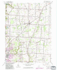
~ New Albany OH topo map, 1:24000 scale, 7.5 X 7.5 Minute, Historical, 1966, updated 1983
New Albany, Ohio, USGS topographic map dated 1966.
Includes geographic coordinates (latitude and longitude). This topographic map is suitable for hiking, camping, and exploring, or framing it as a wall map.
Printed on-demand using high resolution imagery, on heavy weight and acid free paper, or alternatively on a variety of synthetic materials.
Topos available on paper, Waterproof, Poly, or Tyvek. Usually shipping rolled, unless combined with other folded maps in one order.
- Product Number: USGS-5318236
- Free digital map download (high-resolution, GeoPDF): New Albany, Ohio (file size: 9 MB)
- Map Size: please refer to the dimensions of the GeoPDF map above
- Weight (paper map): ca. 55 grams
- Map Type: POD USGS Topographic Map
- Map Series: HTMC
- Map Verison: Historical
- Cell ID: 31628
- Scan ID: 227601
- Imprint Year: 1983
- Woodland Tint: Yes
- Photo Revision Year: 1982
- Aerial Photo Year: 1980
- Edit Year: 1982
- Field Check Year: 1955
- Datum: NAD27
- Map Projection: Polyconic
- Map published by United States Geological Survey
- Map Language: English
- Scanner Resolution: 600 dpi
- Map Cell Name: New Albany
- Grid size: 7.5 X 7.5 Minute
- Date on map: 1966
- Map Scale: 1:24000
- Geographical region: Ohio, United States
Neighboring Maps:
All neighboring USGS topo maps are available for sale online at a variety of scales.
Spatial coverage:
Topo map New Albany, Ohio, covers the geographical area associated the following places:
- Beech - Ackerly Park - Estates At Fieldstone - Oakland - Royal Elm - Hampstead Heath - Clivdon - Creekstone - Stepping Stone - Lansdowne - New Albany - Clivdon Mews - The Greens At Clarenton - Colts Neck - Fenway - Parkwood - Planters Grove - Asbury Heights - Ealy Crossing - Morrison Farms - Villas At Hawks Crest - Wonderland (historical) - Albany Park - The Woods At Havens Run - Woods At Sugar Run - Ovid - Hamptons At New Albany - Lambton Park - Cobblestone At The Preserve - Jefferson Estates - Waggoner Trace - Kitzmiller Crossing - Havens Corners - Cedar Run - Willow Brook Crossing - Jefferson Meadows - Fieldstone - Waggoner Chase - Havenswood - Pinecrest - Wiveliscombe - Pickett Place - Waterston - New Albany Farms - Hampstead Green
- Map Area ID: AREA40.12540-82.875-82.75
- Northwest corner Lat/Long code: USGSNW40.125-82.875
- Northeast corner Lat/Long code: USGSNE40.125-82.75
- Southwest corner Lat/Long code: USGSSW40-82.875
- Southeast corner Lat/Long code: USGSSE40-82.75
- Northern map edge Latitude: 40.125
- Southern map edge Latitude: 40
- Western map edge Longitude: -82.875
- Eastern map edge Longitude: -82.75


