
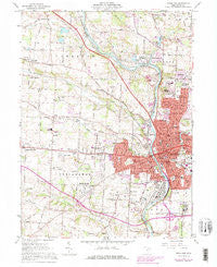
~ Massillon OH topo map, 1:24000 scale, 7.5 X 7.5 Minute, Historical, 1961, updated 1978
Massillon, Ohio, USGS topographic map dated 1961.
Includes geographic coordinates (latitude and longitude). This topographic map is suitable for hiking, camping, and exploring, or framing it as a wall map.
Printed on-demand using high resolution imagery, on heavy weight and acid free paper, or alternatively on a variety of synthetic materials.
Topos available on paper, Waterproof, Poly, or Tyvek. Usually shipping rolled, unless combined with other folded maps in one order.
- Product Number: USGS-5317834
- Free digital map download (high-resolution, GeoPDF): Massillon, Ohio (file size: 12 MB)
- Map Size: please refer to the dimensions of the GeoPDF map above
- Weight (paper map): ca. 55 grams
- Map Type: POD USGS Topographic Map
- Map Series: HTMC
- Map Verison: Historical
- Cell ID: 27979
- Scan ID: 227759
- Imprint Year: 1978
- Woodland Tint: Yes
- Visual Version Number: 2
- Photo Revision Year: 1978
- Aerial Photo Year: 1976
- Edit Year: 1978
- Field Check Year: 1961
- Datum: NAD27
- Map Projection: Polyconic
- Map published by United States Geological Survey
- Map Language: English
- Scanner Resolution: 600 dpi
- Map Cell Name: Massillon
- Grid size: 7.5 X 7.5 Minute
- Date on map: 1961
- Map Scale: 1:24000
- Geographical region: Ohio, United States
Neighboring Maps:
All neighboring USGS topo maps are available for sale online at a variety of scales.
Spatial coverage:
Topo map Massillon, Ohio, covers the geographical area associated the following places:
- Charity Rotch - West Massillon - Greenwood Acres - Pauls (historical) - Mayflower Village - Crystal Springs - Autumn Ridge Estates - Sippo Heights - Gloucester Village - Carrington - Sippo - Crystal Lake Park - Massillon - Columbia - Forty Corners Village - Moffitt Heights - L And S Trailer Park - East Brookfield - Rhodes (historical) - Serenity Shores - Coventry Hills - Scenic Ridge - Spring Valley Estates - Newman - Urban Hill - Oak Ridge - Lawndale - Waterside - Pinn (historical) - Westarado - Rolling Hills Village - New England - Elms Acres - Amherst Heights - West Brookfield - Top of the Hill Mobile Home Park - Audubon Ridge - West Park - Walnut Hills - Clearview - Kendall Heights - Sherwood (historical)
- Map Area ID: AREA40.87540.75-81.625-81.5
- Northwest corner Lat/Long code: USGSNW40.875-81.625
- Northeast corner Lat/Long code: USGSNE40.875-81.5
- Southwest corner Lat/Long code: USGSSW40.75-81.625
- Southeast corner Lat/Long code: USGSSE40.75-81.5
- Northern map edge Latitude: 40.875
- Southern map edge Latitude: 40.75
- Western map edge Longitude: -81.625
- Eastern map edge Longitude: -81.5


