
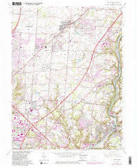
~ Mason OH topo map, 1:24000 scale, 7.5 X 7.5 Minute, Historical, 1965, updated 1982
Mason, Ohio, USGS topographic map dated 1965.
Includes geographic coordinates (latitude and longitude). This topographic map is suitable for hiking, camping, and exploring, or framing it as a wall map.
Printed on-demand using high resolution imagery, on heavy weight and acid free paper, or alternatively on a variety of synthetic materials.
Topos available on paper, Waterproof, Poly, or Tyvek. Usually shipping rolled, unless combined with other folded maps in one order.
- Product Number: USGS-5317816
- Free digital map download (high-resolution, GeoPDF): Mason, Ohio (file size: 13 MB)
- Map Size: please refer to the dimensions of the GeoPDF map above
- Weight (paper map): ca. 55 grams
- Map Type: POD USGS Topographic Map
- Map Series: HTMC
- Map Verison: Historical
- Cell ID: 27947
- Scan ID: 227749
- Imprint Year: 1982
- Woodland Tint: Yes
- Visual Version Number: 2
- Photo Revision Year: 1981
- Aerial Photo Year: 1979
- Edit Year: 1981
- Field Check Year: 1955
- Datum: NAD27
- Map Projection: Polyconic
- Map published by United States Geological Survey
- Map Language: English
- Scanner Resolution: 600 dpi
- Map Cell Name: Mason
- Grid size: 7.5 X 7.5 Minute
- Date on map: 1965
- Map Scale: 1:24000
- Geographical region: Ohio, United States
Neighboring Maps:
All neighboring USGS topo maps are available for sale online at a variety of scales.
Spatial coverage:
Topo map Mason, Ohio, covers the geographical area associated the following places:
- Sunburst Hills - Brecon - Orchard Acres - Country Acres - Kenridge - Highpoint - Socialville - Twightwee - Snidercrest - Brookside Estates - Landen - Sixteen Mile Stand - Emery Acres - Butterworth (historical) - Shawnee Mobile Home Court - Hazelwood - The Woods - Brenner Woods - Mason - Mason Mobile Home Park - Foster - Twenty Mile Stand - Pisgah - Loveland - Sycamore - Stonewall Estates - Miltomson - Loveland Park - Wildwood Acres - Clearview
- Map Area ID: AREA39.37539.25-84.375-84.25
- Northwest corner Lat/Long code: USGSNW39.375-84.375
- Northeast corner Lat/Long code: USGSNE39.375-84.25
- Southwest corner Lat/Long code: USGSSW39.25-84.375
- Southeast corner Lat/Long code: USGSSE39.25-84.25
- Northern map edge Latitude: 39.375
- Southern map edge Latitude: 39.25
- Western map edge Longitude: -84.375
- Eastern map edge Longitude: -84.25


