
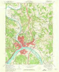
~ Marietta OH topo map, 1:24000 scale, 7.5 X 7.5 Minute, Historical, 1969, updated 1971
Marietta, Ohio, USGS topographic map dated 1969.
Includes geographic coordinates (latitude and longitude). This topographic map is suitable for hiking, camping, and exploring, or framing it as a wall map.
Printed on-demand using high resolution imagery, on heavy weight and acid free paper, or alternatively on a variety of synthetic materials.
Topos available on paper, Waterproof, Poly, or Tyvek. Usually shipping rolled, unless combined with other folded maps in one order.
- Product Number: USGS-5317768
- Free digital map download (high-resolution, GeoPDF): Marietta, Ohio (file size: 13 MB)
- Map Size: please refer to the dimensions of the GeoPDF map above
- Weight (paper map): ca. 55 grams
- Map Type: POD USGS Topographic Map
- Map Series: HTMC
- Map Verison: Historical
- Cell ID: 27695
- Scan ID: 225729
- Imprint Year: 1971
- Woodland Tint: Yes
- Aerial Photo Year: 1968
- Field Check Year: 1969
- Datum: NAD27
- Map Projection: Polyconic
- Map published by United States Geological Survey
- Map Language: English
- Scanner Resolution: 600 dpi
- Map Cell Name: Marietta
- Grid size: 7.5 X 7.5 Minute
- Date on map: 1969
- Map Scale: 1:24000
- Geographical region: Ohio, United States
Neighboring Maps:
All neighboring USGS topo maps are available for sale online at a variety of scales.
Spatial coverage:
Topo map Marietta, Ohio, covers the geographical area associated the following places:
- Emerson Heights - Marietta - Riverdale - Oakwood Park - Fairview Heights - East Norwood - Moore Junction - Rathbone - Rainbow - East Norwood Trailer Park - West Marietta - Oak Grove - Westview - Muskingum Terrace - Caywood - Pohick - Devola - Sandhill - Morningside - Marietta Marina Trailer Park - Arlington Heights - Rathbone Heights - North Hills - Friendly Acres - Stanleyville - Norwood Mobile Home Park - Harmar - Western Hills - Mount Everett - Williamstown - Pinehurst - Unionville - Norwood - Longvue - Springdale - Ruraldale - Putnam Place - Grand View - Emerson
- Map Area ID: AREA39.539.375-81.5-81.375
- Northwest corner Lat/Long code: USGSNW39.5-81.5
- Northeast corner Lat/Long code: USGSNE39.5-81.375
- Southwest corner Lat/Long code: USGSSW39.375-81.5
- Southeast corner Lat/Long code: USGSSE39.375-81.375
- Northern map edge Latitude: 39.5
- Southern map edge Latitude: 39.375
- Western map edge Longitude: -81.5
- Eastern map edge Longitude: -81.375


