
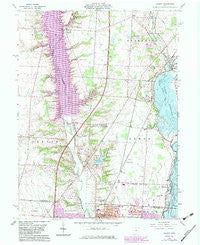
~ Galena OH topo map, 1:24000 scale, 7.5 X 7.5 Minute, Historical, 1964, updated 1983
Galena, Ohio, USGS topographic map dated 1964.
Includes geographic coordinates (latitude and longitude). This topographic map is suitable for hiking, camping, and exploring, or framing it as a wall map.
Printed on-demand using high resolution imagery, on heavy weight and acid free paper, or alternatively on a variety of synthetic materials.
Topos available on paper, Waterproof, Poly, or Tyvek. Usually shipping rolled, unless combined with other folded maps in one order.
- Product Number: USGS-5316650
- Free digital map download (high-resolution, GeoPDF): Galena, Ohio (file size: 11 MB)
- Map Size: please refer to the dimensions of the GeoPDF map above
- Weight (paper map): ca. 55 grams
- Map Type: POD USGS Topographic Map
- Map Series: HTMC
- Map Verison: Historical
- Cell ID: 16667
- Scan ID: 225137
- Imprint Year: 1983
- Woodland Tint: Yes
- Photo Revision Year: 1983
- Aerial Photo Year: 1980
- Edit Year: 1983
- Field Check Year: 1955
- Datum: NAD27
- Map Projection: Polyconic
- Map published by United States Geological Survey
- Map Language: English
- Scanner Resolution: 600 dpi
- Map Cell Name: Galena
- Grid size: 7.5 X 7.5 Minute
- Date on map: 1964
- Map Scale: 1:24000
- Geographical region: Ohio, United States
Neighboring Maps:
All neighboring USGS topo maps are available for sale online at a variety of scales.
Spatial coverage:
Topo map Galena, Ohio, covers the geographical area associated the following places:
- Walker Woods - Walnut Woods - Sheffield Park - Running Fox Estates - Piatt Meadows - The Shores - Summerwood - Hidden Cove - Africa - The Woods At Bale Kenyon - Sunbury Meadows - Woodstone - Meadows At Lewis Center - Alum Crossing - Cheshire - Cheshire Woods - Parkshore - Hidden Creek - Arbors At Cheshire - Galena - Vinmar Farms - Willow Springs - Abbey Knoll - Summerfield - Waverly Place - The Woods At Cross Creek - Crystal Valley - Courtyards At Little Bear - Cheshire Cove - Bryn Mawr - Harbor Pointe - Victory Camp - Heather Glen - Meadows At Cheshire - Westerville - Grand Oak - Walnut Grove Estates - Avonlea - Mackstown - Wilshire - Rome - McCammon Estates - Hickory Woods - Mansard Estates
- Map Area ID: AREA40.2540.125-83-82.875
- Northwest corner Lat/Long code: USGSNW40.25-83
- Northeast corner Lat/Long code: USGSNE40.25-82.875
- Southwest corner Lat/Long code: USGSSW40.125-83
- Southeast corner Lat/Long code: USGSSE40.125-82.875
- Northern map edge Latitude: 40.25
- Southern map edge Latitude: 40.125
- Western map edge Longitude: -83
- Eastern map edge Longitude: -82.875


