
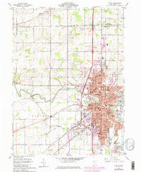
~ Findlay OH topo map, 1:24000 scale, 7.5 X 7.5 Minute, Historical, 1960, updated 1980
Findlay, Ohio, USGS topographic map dated 1960.
Includes geographic coordinates (latitude and longitude). This topographic map is suitable for hiking, camping, and exploring, or framing it as a wall map.
Printed on-demand using high resolution imagery, on heavy weight and acid free paper, or alternatively on a variety of synthetic materials.
Topos available on paper, Waterproof, Poly, or Tyvek. Usually shipping rolled, unless combined with other folded maps in one order.
- Product Number: USGS-5316482
- Free digital map download (high-resolution, GeoPDF): Findlay, Ohio (file size: 10 MB)
- Map Size: please refer to the dimensions of the GeoPDF map above
- Weight (paper map): ca. 55 grams
- Map Type: POD USGS Topographic Map
- Map Series: HTMC
- Map Verison: Historical
- Cell ID: 15271
- Scan ID: 225050
- Imprint Year: 1980
- Woodland Tint: Yes
- Photo Revision Year: 1979
- Aerial Photo Year: 1977
- Edit Year: 1979
- Survey Year: 1960
- Datum: NAD27
- Map Projection: Polyconic
- Map published by United States Geological Survey
- Map Language: English
- Scanner Resolution: 600 dpi
- Map Cell Name: Findlay
- Grid size: 7.5 X 7.5 Minute
- Date on map: 1960
- Map Scale: 1:24000
- Geographical region: Ohio, United States
Neighboring Maps:
All neighboring USGS topo maps are available for sale online at a variety of scales.
Spatial coverage:
Topo map Findlay, Ohio, covers the geographical area associated the following places:
- Clearwater Trailer Park - Highland Estates - West Park - Mortimer - Deer Ridge Mobile Home Park - Riverview Terrace Park - Chase - South Findlay - Thomas Northview Trailer Court - Findlay - Portage Center - Cedar Tree Estates - Oak Avenue Mobile Home Park - Murphys
- Map Area ID: AREA41.12541-83.75-83.625
- Northwest corner Lat/Long code: USGSNW41.125-83.75
- Northeast corner Lat/Long code: USGSNE41.125-83.625
- Southwest corner Lat/Long code: USGSSW41-83.75
- Southeast corner Lat/Long code: USGSSE41-83.625
- Northern map edge Latitude: 41.125
- Southern map edge Latitude: 41
- Western map edge Longitude: -83.75
- Eastern map edge Longitude: -83.625


