
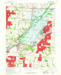
~ Fairborn OH topo map, 1:24000 scale, 7.5 X 7.5 Minute, Historical, 1965, updated 1967
Fairborn, Ohio, USGS topographic map dated 1965.
Includes geographic coordinates (latitude and longitude). This topographic map is suitable for hiking, camping, and exploring, or framing it as a wall map.
Printed on-demand using high resolution imagery, on heavy weight and acid free paper, or alternatively on a variety of synthetic materials.
Topos available on paper, Waterproof, Poly, or Tyvek. Usually shipping rolled, unless combined with other folded maps in one order.
- Product Number: USGS-5316424
- Free digital map download (high-resolution, GeoPDF): Fairborn, Ohio (file size: 10 MB)
- Map Size: please refer to the dimensions of the GeoPDF map above
- Weight (paper map): ca. 55 grams
- Map Type: POD USGS Topographic Map
- Map Series: HTMC
- Map Verison: Historical
- Cell ID: 14792
- Scan ID: 225020
- Imprint Year: 1967
- Woodland Tint: Yes
- Photo Revision Year: 1965
- Aerial Photo Year: 1964
- Field Check Year: 1965
- Survey Year: 1955
- Datum: NAD27
- Map Projection: Polyconic
- Map published by United States Geological Survey
- Map Language: English
- Scanner Resolution: 600 dpi
- Map Cell Name: Fairborn
- Grid size: 7.5 X 7.5 Minute
- Date on map: 1965
- Map Scale: 1:24000
- Geographical region: Ohio, United States
Neighboring Maps:
All neighboring USGS topo maps are available for sale online at a variety of scales.
Spatial coverage:
Topo map Fairborn, Ohio, covers the geographical area associated the following places:
- Fairborn - Huffeysville (historical) - Riverside - Pleasant View - Huber Heights - Park Hills Crossing - South Point Village Mobile Home Park - Page Manor - Fairborn Mobile Home Park - Huber Mobile Home Park - Simms (historical) - McMahan Mobile Home Park - Crown Village Mobile Park - Thomas Trailer Park - New Germany - Upper Valley Trailer Court - Wright Patterson Mobile Home Park - Red Oak Mobile Home Park - Woodland Hills - Five Points - Buckeye Mobile Home Park - Womacks Mobile Home Park - Fairway Terrace Mobile Home Park - Sulphur Grove - Wrightview - Beverly Gardens - Sherman's Trailer Park
- Map Area ID: AREA39.87539.75-84.125-84
- Northwest corner Lat/Long code: USGSNW39.875-84.125
- Northeast corner Lat/Long code: USGSNE39.875-84
- Southwest corner Lat/Long code: USGSSW39.75-84.125
- Southeast corner Lat/Long code: USGSSE39.75-84
- Northern map edge Latitude: 39.875
- Southern map edge Latitude: 39.75
- Western map edge Longitude: -84.125
- Eastern map edge Longitude: -84


