
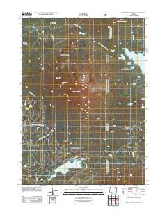
~ Mount McLoughlin OR topo map, 1:24000 scale, 7.5 X 7.5 Minute, Historical, 2011
Mount McLoughlin, Oregon, USGS topographic map dated 2011.
Includes geographic coordinates (latitude and longitude). This topographic map is suitable for hiking, camping, and exploring, or framing it as a wall map.
Printed on-demand using high resolution imagery, on heavy weight and acid free paper, or alternatively on a variety of synthetic materials.
Topos available on paper, Waterproof, Poly, or Tyvek. Usually shipping rolled, unless combined with other folded maps in one order.
- Product Number: USGS-5311734
- Free digital map download (high-resolution, GeoPDF): Mount McLoughlin, Oregon (file size: 26 MB)
- Map Size: please refer to the dimensions of the GeoPDF map above
- Weight (paper map): ca. 55 grams
- Map Type: POD USGS Topographic Map
- Map Series: US Topo
- Map Verison: Historical
- Cell ID: 30710
- Datum: North American Datum of 1983
- Map Projection: Transverse Mercator
- Map Cell Name: Mount McLoughlin
- Grid size: 7.5 X 7.5 Minute
- Date on map: 2011
- Map Scale: 1:24000
- Geographical region: Oregon, United States
Neighboring Maps:
All neighboring USGS topo maps are available for sale online at a variety of scales.
Spatial coverage:
Topo map Mount McLoughlin, Oregon, covers the geographical area associated the following places:
- Squaw Tip Trail (historical) - Fish Lake Resort - Fish Lake Dam - North Squaw Tip - Valley of the Rogue Dairy - Crater Trail - Fish Lake Recreation Site - Medford Watershed - Fish Lake - Calamity Forest Camp (historical) - Squaw Lake - Twin Ponds - Twin Ponds Trail - South Squaw Tip - Twin Ponds Camp - Camp Seventy-six - Fish Lake Resort Marina - Doe Point Recreation Site - Mount McLoughlin Trail - Dogwood Spring - Rye Spring - Norris Pond - Summit Lake - Blue Rock Trail - Fourmile Lake - Bourbon Spring - Mirror Pond - Cold Springs - North Fork Recreation Site - Summit Sno-Park - Swan Creek - Freye Lake - Mount McLoughlin - Doe Point - High Lakes Pass - Orris Pond - Dry Creek Camp - Rye Flat
- Map Area ID: AREA42.542.375-122.375-122.25
- Northwest corner Lat/Long code: USGSNW42.5-122.375
- Northeast corner Lat/Long code: USGSNE42.5-122.25
- Southwest corner Lat/Long code: USGSSW42.375-122.375
- Southeast corner Lat/Long code: USGSSE42.375-122.25
- Northern map edge Latitude: 42.5
- Southern map edge Latitude: 42.375
- Western map edge Longitude: -122.375
- Eastern map edge Longitude: -122.25


