
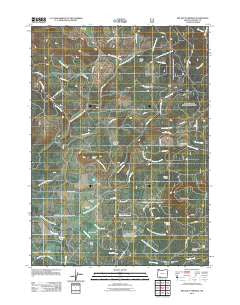
~ Big Butte Springs OR topo map, 1:24000 scale, 7.5 X 7.5 Minute, Historical, 2011
Big Butte Springs, Oregon, USGS topographic map dated 2011.
Includes geographic coordinates (latitude and longitude). This topographic map is suitable for hiking, camping, and exploring, or framing it as a wall map.
Printed on-demand using high resolution imagery, on heavy weight and acid free paper, or alternatively on a variety of synthetic materials.
Topos available on paper, Waterproof, Poly, or Tyvek. Usually shipping rolled, unless combined with other folded maps in one order.
- Product Number: USGS-5311718
- Free digital map download (high-resolution, GeoPDF): Big Butte Springs, Oregon (file size: 29 MB)
- Map Size: please refer to the dimensions of the GeoPDF map above
- Weight (paper map): ca. 55 grams
- Map Type: POD USGS Topographic Map
- Map Series: US Topo
- Map Verison: Historical
- Cell ID: 3661
- Datum: North American Datum of 1983
- Map Projection: Transverse Mercator
- Map Cell Name: Big Butte Springs
- Grid size: 7.5 X 7.5 Minute
- Date on map: 2011
- Map Scale: 1:24000
- Geographical region: Oregon, United States
Neighboring Maps:
All neighboring USGS topo maps are available for sale online at a variety of scales.
Spatial coverage:
Topo map Big Butte Springs, Oregon, covers the geographical area associated the following places:
- Hoffman Ranch - North Fork Clarks Fork Creek - Oak Mountain - Mud Spring - Oden Ranch - Timberline Creek - Horseshoe Creek - Titanic Creek - Deception Creek - Blue Cow Spring - Rancheria Ranch - Phillips Creek - Camp Creek - Parker (historical) - West Fork Ash Creek - Twincheria Creek - Fireline Creek - Willow Creek - Doug Ingram Tree - Northern Glades - Ash Creek - Camp Four - Cedar Springs Creek - Mule Creek - Rancheria Prairie - Jackass Creek - Carlson Camp - South Fork Clarks Fork Creek - Mount Pitt School - East Fork Ash Creek - Big Butte Springs - Rancheria Creek - Clement Ranch - Fourbit Creek - Thomson Ranch - Lemont Post Office (historical) - Fourbit Ford Recreation Site - Fourbit Ford - Clarks Fork Creek - Friese Creek - Merle Burn - Goss Ranch - Cook Ranch - Grouse Ridge
- Map Area ID: AREA42.62542.5-122.5-122.375
- Northwest corner Lat/Long code: USGSNW42.625-122.5
- Northeast corner Lat/Long code: USGSNE42.625-122.375
- Southwest corner Lat/Long code: USGSSW42.5-122.5
- Southeast corner Lat/Long code: USGSSE42.5-122.375
- Northern map edge Latitude: 42.625
- Southern map edge Latitude: 42.5
- Western map edge Longitude: -122.5
- Eastern map edge Longitude: -122.375


